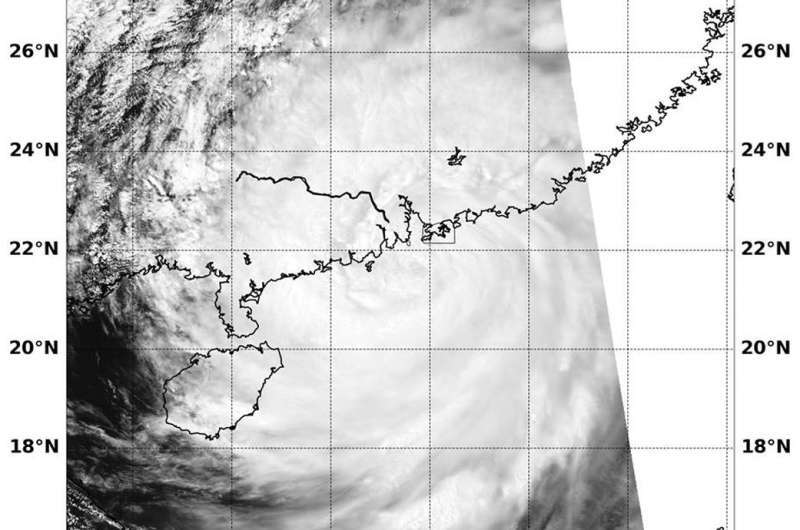
Warnings were up for Hong Kong for Typhoon Mangkhut after landfall

On Sunday, Sept. 16, Typhoon Mangkhut had made landfall in southern China and Hurricane signal #10 was still in force. NASA's Aqua satellite passed over the storm and captured an image that showed the storm after landfall.
A Red Alert, the most severe warning was issued by authorities in southern China.
At 5 a.m EDT (0900 UTC) on Sunday, Sept. 16, Mangkhut was centered near 21.6 north latitude and 113.6 east longitude, about 54 miles southwest of Hong Kong. Mangkhut was moving to the west-northwest at 17 knots and had maximum sustained winds 80 knots (92 mph/148 kph)
NASA's Aqua satellite provided a visible look at the storm on Sept. 16 on 2:20 a.m. EDT (0620 UTC) after it made landfall in China. The image showed the cloud-filled center of the storm over the coast. The storm brought surges as high as 3 meters (approx. 9 feet) around Hong Kong.
On Sunday evening, local time, Typhoon Mangkhut made landfall in southern China's Guangdong province,
After landfall, the storm moved inland and continued to weaken, dropping very heavy rainfall.
Provided by NASA's Goddard Space Flight Center


