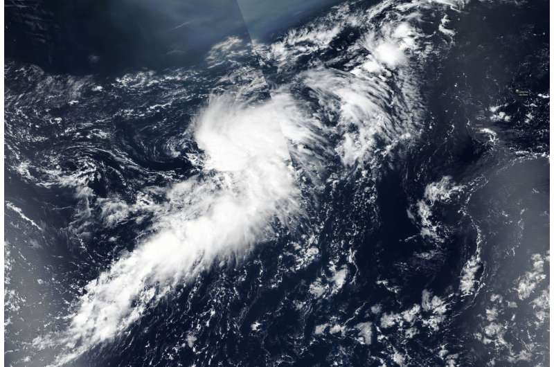
NASA catches formation of fifth Atlantic depression

The fifth tropical cyclone of the North Atlantic Ocean season formed on Aug. 15, as NASA-NOAA's Suomi NPP satellite flew overhead.
Like its predecessor Tropical Storm Debby, Sub-Tropical Depression 05L (5) formed in the north central Atlantic Ocean.
On Aug. 15, the Visible Infrared Imaging Radiometer Suite (VIIRS) instrument aboard NASA-NOAA's Suomi NPP satellite captured a visible image of Tropical Depression 5 that showed a large storm. Most of the convection and clouds appeared east of center and there was a large band of thunderstorms extending to the south.
At 5 a.m. EDT (0900 UTC), the center of Subtropical Depression Five was located near latitude degrees 37.6 north and longitude 45.6 degrees west. That's 1,015 miles (1,630 km) west of the Azores. The subtropical depression is moving toward the north near 5 mph (7 kph), and this general motion with a slight increase in forward speed is expected today. A faster northeastward motion is forecast to occur on Thursday and Friday.
Maximum sustained winds are near 35 mph (55 kph) with higher gusts. Some strengthening is forecast during the next day or so, and the subtropical depression is expected to become a subtropical storm later today.
Provided by NASA's Goddard Space Flight Center


