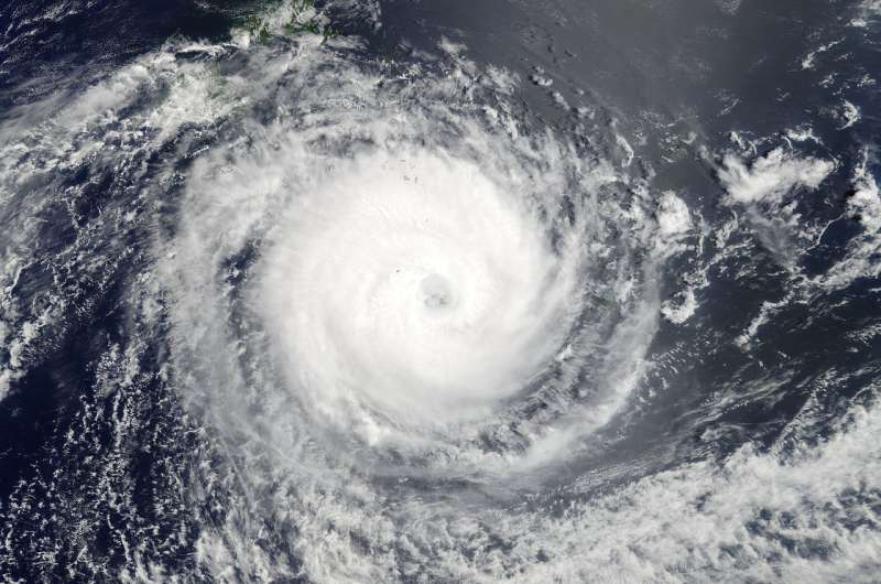
NASA eyes powerful Tropical Cyclone Gita in the South Pacific

NASA's Terra satellite provided a visible image of Category 3 Tropical Cyclone Gita as it continues to bring heavy rainfall, powerful winds and storm surge to Fiji Islands after pounding the island of Tonga.
On Feb. 12, Gita hit Tonga with the force of a Category 4 hurricane with powerful winds and heavy rainfall, destroying structures and causing flooding. Tonga is a Polynesian kingdom that consists of more than 170 South Pacific islands, many uninhabited. The Tongan government declared a state of emergency on Monday, Feb. 12 and advised the public to stay off the roads. A statement from the Australian Minister of Foreign Affairs noted that Australia and New Zealand were sending humanitarian aid to Tonga.
A Category 3 hurricane on the Saffir-Simpson Hurricane Wind scale is a major hurricane. The scale defines a Category 3 storm as "Well-built framed homes may incur major damage or removal of roof decking and gable ends. Many trees will be snapped or uprooted, blocking numerous roads. Electricity and water will be unavailable for several days to weeks after the storm passes."
On Feb. 13 at 10 a.m. EST (1500 UTC) Tropical Cyclone Gita had maximum sustained winds near 126.6 mph (110 knots/203.7 kph). Gita's eye was located near 21.1 degrees south latitude and 179.1 degrees east longitude, about 190 nautical miles south-southeast of Suva, Fiji. Gita has tracked westward at 10.3 mph (9 knots/16.6 kph)
The Moderate Resolution Imaging Spectroradiometer or MODIS instrument that flies aboard NASA's Terra satellite saw powerful Tropical Cyclone Gita in the South Pacific Ocean on Feb. 12 at 5:20 p.m. EST (22:20 UTC). The image depicts a well-organized and symmetric tropical cyclone with a distinct eye feature.
The Joint Typhoon Warning Center noted that "Upper level analysis shows moderate to unfavorable vertical wind shear, ranging from 25 to 30 knots. The vertical wind shear is offset by a strong poleward outflow channel. Sea surface temperatures remain favorable between 28 and 29 degrees Celsius (82.4 to 84.2 degrees Fahrenheit)."
Tropical cyclones need at least 26.6 degrees Celsius (80 degrees Fahrenheit to form or maintain strength).
On Feb. 13, warnings were in effect for Fiji. A Gale Warning remained in effect for Ono-I-Lau, Vatoa, Matuku, Totoya, Moala, Kadavu and nearby smaller islands and is cancelled for the rest of southern Lau. A strong wind warning remains in force for the rest of Fiji.
For updates from the Tonga Meteorological & Coast Radio Services, visit: http://www.met.gov.to/. For updates from the Fiji Meteorological Service, visit: http://www.met.gov.fj/.
Gita is still under the influence of the sub-tropical ridge (elongated area) of high pressure, located to the south and is still being steered westward. The ridge will continue to steer Gita generally westward through the next two days keeping the eye over open waters, south of New Caledonia.
Provided by NASA's Goddard Space Flight Center


