GPM satellite finds rainfall pushed away from Tropical Cyclone Cebile's center

Vertical wind shear continued to hammer Tropical Cyclone Cebile in the Southern Pacific Ocean and NASA's GPM core satellite saw rainfall was pushed away from the center.
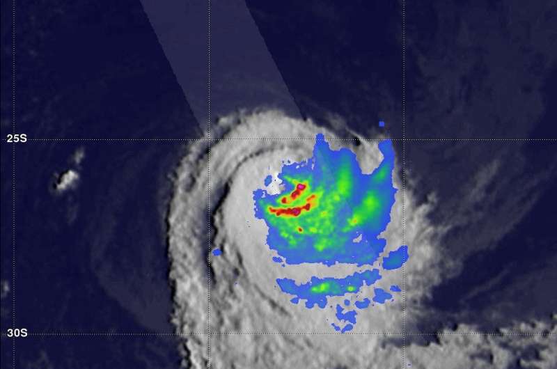
The GPM or Global Precipitation Measurement mission core observatory satellite passed above weakening tropical cyclone Cebile on February 6, 2018 at 6:51 a.m. EST (1151 UTC). The satellite showed that most of the convective rainfall in the sheared tropical cyclone was southeast of Cebile's center of circulation.
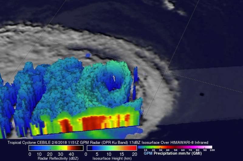
The Dual Frequency Precipitation Radar (DPR) instrument aboard GPM showed that the northeastern side of the eye wall was eroding while continuous heavy precipitation was found by GPM in the southeastern quadrant of the storm. GPM found that powerful storms on the southern side of the tropical cyclone were still dropping rain at a rate of greater than 126.8 mm (4.99 inches) per hour.
GPM is a joint mission between NASA and the Japanese space agency JAXA.
GPM's radar (DPR Ku Band) revealed that precipitation radar returns were weak to scattered on the northern side of the tropical cyclone while rainfall on the southern side was returning continuous solid echoes. The heaviest rainfall was shown southeast of Cebile's center of circulation but the highest storm tops, reaching about 10 km (6.2 miles), were found by DPR in Cebile's eye wall on the western side of the tropical cyclone.
On Thursday, Feb. 7 at 10 a.m. EST (1500 UTC) Tropical cyclone Cebile was located near 26.7 south latitude and 80.5 east longitude. That's about 1,384 nautical miles east-southeast of La Reunion Island. Cebile was moving to the west at 7 mph (6 knots/11 kph) and had maximum sustained winds near 46.6 mph (40 knots/74 kph).
The Joint Typhoon Warning Center (JTWC) predicts that Cebile will continue to weaken due to increasing vertical wind shear and cooling ocean waters. Dissipation is expected within a day.

Provided by NASA's Goddard Space Flight Center


