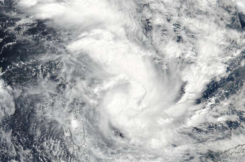
Suomi NPP spots formation of Tropical Cyclone Donna

The tropical low pressure area previously known as System 99P organized and developed into tropical cyclone Donna in the South Pacific and now threatens Vanuatu. NASA-NOAA's Suomi NPP satellite provided visible and infrared data on the newly developed storm.
Donna developed into a tropical storm on May 2 at 2100 UTC (5 p.m. EDT) about 484 nautical miles northwest of Suva, Fiji.
On May 3 at 0224 UTC (May 2 at 10:24 p.m. EDT) the Visible Infrared Imaging Radiometer Suite (VIIRS) instrument aboard the NASA-NOAA Suomi NPP satellite captured a visible image of the newly developed tropical storm. The VIIRS image showed strong thunderstorms around the center of circulation and extending to the north in a large thick band.
At 0900 UTC (5 a.m. EDT), Donna's maximum sustained winds had increased to 55 knots (63 mph/102 kph). It was located near 12.7 degrees south latitude and 171.0 degrees east longitude, about 344 nautical miles north-northeast of Port Vila, Vanuatu. Donna has tracked westward at 5 knots (5.7 mph/9.2 kph).
A Severe Weather Warning Bulletin for Northern and Central Vanuatu group issued by the Vanuatu Meteorology and Geo-Hazards Department, Port Vila at 5 a.m. local time, Tuesday, May 2, 2017. The warning noted "rain [is expected] with isolated heavy falls and thunderstorm over Northern and Central Vanuatu group. People are advised to take extra precautions for possible flash flooding; especially areas close to river banks and in low lying areas, and to remain indoors where thunderstorm activities are happening."
The Joint Typhoon Warning Center said "the system has steadily intensified, and become increasingly organized, under the favorable influences of strong poleward outflow aloft, low vertical wind shear and passage over very warm water."
The Joint Typhoon Warning Center expects Donna to reach hurricane force and head southwest, turning southeast and moving from north to south over Vanuatu from May 5 to May 8.
For forecast updates from the Vanuatu Meteorological Services, visit: http://www.meteo.gov.vu/.
Provided by NASA's Goddard Space Flight Center


