Octocopter! Experimental drone for agricultural research
Following the revelation that English Premiership football club Everton FC is using drones to monitor player training sessions, it seems there's nothing these Unmanned Aerial Vehicles (UAVs) aren't being primed to do: everything from delivering post (and pizza!) to security, defence and recording home movies and major sporting events.
It's too early to say which will be novelty uses as opposed to daily realities, but above the green fields of Hertfordshire scientists have been busy for more than a year running pilot(less) studies to see what drones could bring to agricultural research.
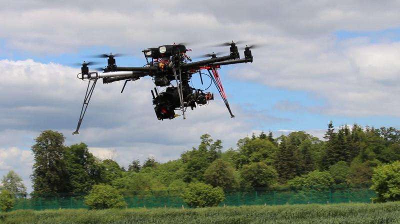
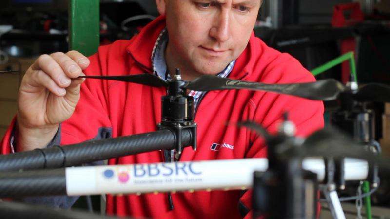
An advanced eight-rotor model dubbed the octocopter (see 'Flight-al statistics' below), has been put through its paces by researchers led by Andrew Riche of Rothamsted Research, an institute devoted to plant, soil and agricultural science that receives strategic funding from UK bioscience funders BBSRC.
Rothamsted is the site of the longest running field experiments in the world, where farm systems and inputs such as fertiliser, pesticides and crop growth have been running for more than a hundred years. In the 21st century, they want to see if drone surveillance can take much of the drudgery and footwork out of these large-scale experiments that span over 200 hectares of picturesque English countryside. As a demonstrator technology, the researchers are embarking on a rigorous programme of regularly recording experiments over five hectares (the size of seven football pitches) to see exactly what this airborne marvel is capable of.
"This year we have focused on monitoring crop height through the season and also crop maturity, says Riche. "Different wheat lines mature at different rates, and we regularly monitor this on the ground – this year we hope to have done it from the air."
Eye in the sky
The octocopter is an enabling technology. It can be controlled manually or fly itself via GPS, and is fitted with special cameras that can image crop growth, and probably much more.
The craft has a regular RGB (red blue green) imager as in a conventional digital camera. It also has a TIR (thermal infrared) camera which can be used to monitor the crop canopy or soil temperature. The canopy temperature can give an indication of crop stress, because when plants experience drought for example their temperature rises as they stop evaporating water from their leaves.
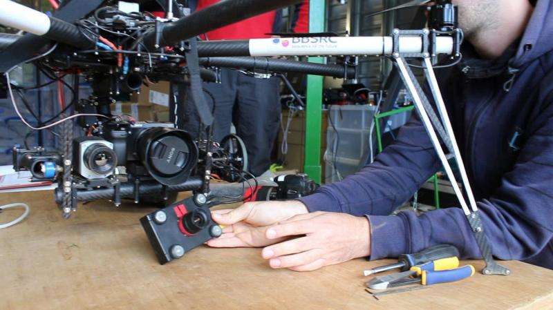
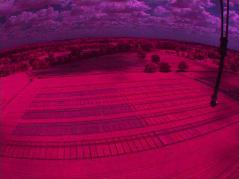
The octocopter also carries a NIR (near infrared, also called multispectral) camera that takes images from which a measure called the Normalised Difference Vegetation Index (NDVI) can be calculated. NDVI gives an estimate of crop biomass, which is essentially the growth that scientists want to know when comparing different plant varieties or growing systems.
"We have found that we can measure crop height accurately from the images. We can also measure NDVI from images, usually we take these measurements on the ground, but the octocopter should be much quicker," says Riche.
Besides speed, other advantages include measurements that will be more accurate and consistent than if done by the human eye; it also frees up time for research assistants to tackle other projects – 16 minutes flight time could collect maturity data that would take four hours to collect in the normal way. However, some time is spent preparing for flying and then downloading and extracting data post-flight.
Crunch time
The process by which individual photographs taken on the copter's boom are translated into growth data demonstrates just how far imaging technology has developed since the advent of the first digital cameras.
In the first step, images are fed into software that aligns them to be geometrically uniform and true to scale in a process called orthorectification. "This means it makes them appear that they were taken parallel to the ground even if the camera was at an angle when the picture was taken," Riche explains.
The images are then added around each other into a large mosaic. With up to 500 images of a single experiment, there's a lot of overlap and the software (Agisoft Photoscan) stiches the images together to make one large orthomosaic. Next, the image is geolocated so it is located in real space and has proper scale, and this means meaningful measurements can now be taken from the image. The geolocation uses permanent markers ('ground control points') located within the experimental area, and accurately located by precision GPS – accurate to an astonishing 1cm.
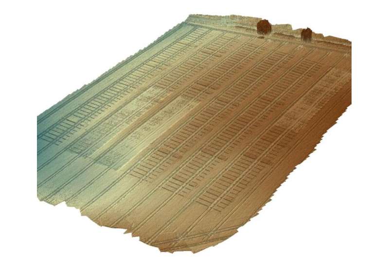
"Finally the software produces a three dimensional model of the imaged area, using the large amount of individual images to build the 3D model," says Riche. "From the 3D model the height of the crop can be extracted, with different values for each individual plot."
Legislating for the future
Besides data on growth, crop colour could also be an important indicator. Plant pathogens such as wheat rusts and certain viruses cause a characteristic yellowing of the crop. In the future, analysis of images could pinpoint areas for treatment with pesticides or biological agents like natural predators.
There are many other uses for drones in agriculture. In other countries farmers are using them to sow seeds and apply pesticides, and in forestry and national parks there are many applications, particularly in essential monitoring over very large areas.
It's not too hard to see a future where an automated drone could search fields for areas of crop damage from pests, or see nutrient- or water-stressed plants from above that the human eye would miss. The drone could then feed the GPS co-ordinates to a farm worker, who could then manage the appropriate response. As the physical capability of drones increases, as well as reliability, you have to wonder if the drones themselves could not spray pesticides and drop fertiliser pellets in the right space and in ultra-low quantities, negating the need to treat entire fields with heavy tractors that can compact the ground and damage soil.
But Riche doesn't think all these uses are likely to happen in the UK anytime soon. "There are currently companies offering a service to farmers for monitoring fields by UAV, however this is a specialist area at present, as current legislation makes it difficult to operate UAVs over a large area," he says. "And I think we are a long way from seeing seeds or pesticides being applied by UAV, however I think they have an important role in monitoring field experiments".
Automatic for the people
Indeed, many people might feel uncomfortable with this level of automated capability, even with clear evidence of environmental benefits. In fact, just getting the octocopter in the air requires strict adherence to a number of regulations. Riche and his co-pilot research assistant March Castle cannot fly (manually or under GPS) within 50m of people not under their control. And they cannot fly higher than 122m, or more than 500m from the operator. "As the aircraft is greater than 7kg and we are within controlled airspace by being close to Luton Airport, we have to ring air traffic control each day that we fly to get permission," says Riche.
Becoming familiar with myriad regulations in so many different areas – everything from piloting skills to technical knowledge of multi-rotor UAVs, to gauging tomorrow's weather (no, it can't fly in rain) – has made the project frustrating at times. But as the camera and software systems have come together there is a the satisfying knowledge that good data can be collected efficiently using the UAV, as well as the tantalising expectation of what could come next.
The octocopter has a modular boom, meaning imaging upgrades and new technologies could be bolted on relatively easily. These could include a hyperspectral camera that can measure reflected light at many more wavelengths than conventional cameras, used by the oil industry to locate deposits, or LiDAR (light detection and ranging) for more accurate 3D images which has been used to map the hidden sites of Stonehenge.
And at £24,000 for the whole system with cameras sounds expensive, until you compare it to the £120,000 cost of a modern GPS-enabled tractor, or just the human hours needed to record information in large-scale experiments.
Just as drones might come to become a regular part of life in everything from postal delivery to monitoring and capturing sport and leisure activities, so the octocopter might well demonstrate a new, enabling capability for modern 'Big Data' agricultural bioscience.
Flight-al statistics
Rotors: 8
Cost (unit): £12 000 for the octocopter
Cost (for whole system with cameras and flight controller): £24, 000
Weight: 9kg including payload and batteries
Range on one full charge: 8km
Flying time on one full charge: 13 min
Ceiling (how high can it go?): 122m legally
Payload weight: 2.5kg
Time to recharge batteries: 1 hr
Camera resolution: 1cm/pixel @ 45m altitude
Camera options: RGB, thermal infrared, multispectral


