NASA sees Tropical Storm Erika approaching the Lesser Antilles

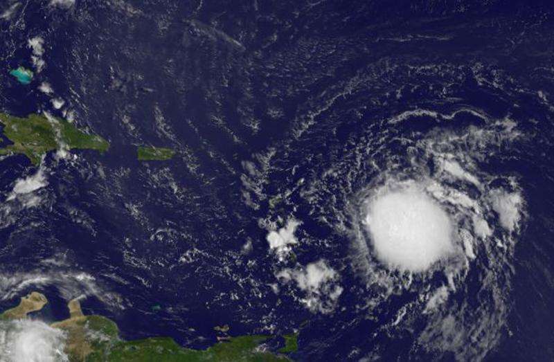
As Tropical Storm Ericka continued moving toward the Lesser Antilles, NASA's Aqua and other satellites were gathering data. Satellite imagery showed strong thunderstorms wrapped around Erika's center.
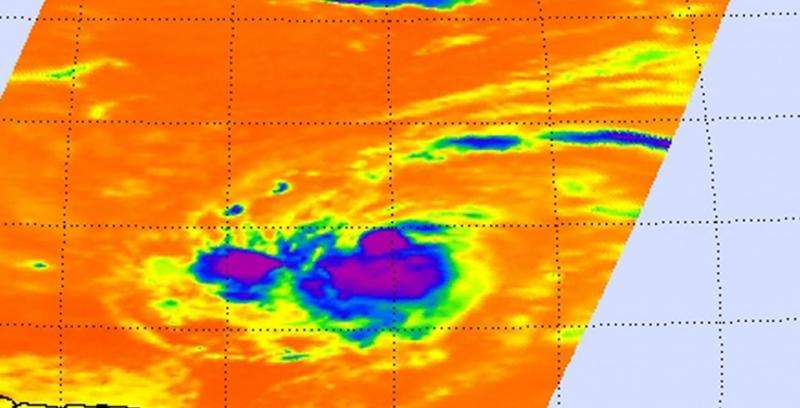
Infrared data, such as that gathered by the Atmospheric Infrared Sounder (AIRS) instrument that flies aboard NASA's Aqua satellite is used to determine cloud top temperature. The colder the cloud tops, the higher they are in the atmosphere, and they are usually stronger. Cloud tops around Erika's center were near -63F/-53C, indicating strong thunderstorms.
A Tropical Storm Warning is in effect for Anguilla, Saba and St. Eustatius, St. Maarten, Montserrat, Antigua and Barbuda, St. Kitts and Nevis, Puerto Rico, Vieques, Culebra, U.S. Virgin Islands, British Virgin Islands. A Tropical Storm Watch is in effect for Guadeloupe, St. Martin, St. Barthelemy.
At 8 a.m. EDT (1200 UTC) on Wednesday, August 26, the center of Tropical Storm Erika was located near latitude 16.2 North, longitude 56.8 West. The National Hurricane Center (NHC) said that Erika was moving toward the west near 17 mph (28 kph), and a west to west-northwestward motion is expected over the next two days. Data from an Air Force Reserve Hurricane Hunter aircraft indicate that the maximum sustained winds have increased to near 45 mph (75 kph) with higher gusts. The latest minimum central pressure reported by an Air Force Reserve Hurricane Hunter aircraft is 1005 millibars.
NHC said Erika is expected to produce total rain accumulations of 2 to 4 inches with maximum amounts of 8 inches across portions of the Leeward Islands, the Virgin Islands, and Puerto Rico through Friday morning, August 28. Some slow strengthening is forecast during the next 48 hours. For updated watches and warnings, visit the National Hurricane Center website: http://www.nhc.noaa.gov.
According to the NHC forecast track, the center of Erika will move near or over portions of the Leeward Islands tonight and move near the Virgin Islands and Puerto Rico on Thursday, August 27.

Provided by NASA's Goddard Space Flight Center


