RapidScat identifies Typhoon Nangka's strongest side

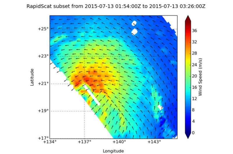
Typhoon Nangka's strongest typhoon-force winds were located on the northern half of the storm, as identified from the RapidScat instrument that flies aboard the International Space Station.
RapidScat gathered surface wind data on the Typhoon Nangka on July 13 from 01:54 to 3:26 UTC (July 12, 9:54 p.m. to 11:26 p.m. EDT). RapidScat data showed that the strongest sustained winds stretched from northwest to northeast of the center at speeds up to 36 meters per second (129 kph/80 mph).
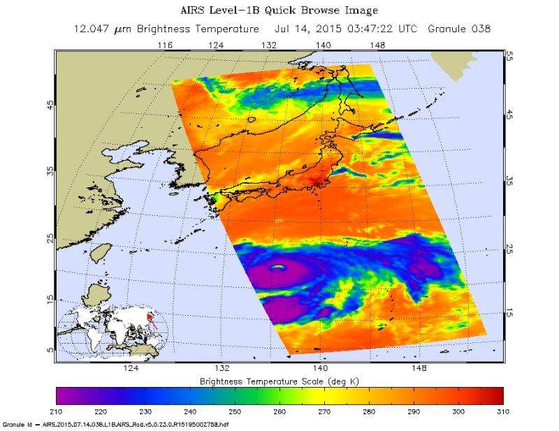
On July 14 at 03:47 UTC the Atmospheric Infrared Sounder or AIRS instrument aboard NASA's Aqua satellite gathered infrared data on the typhoon. There were powerful thunderstorms with very cold cloud top temperatures surrounding the eye of the storm. Temperatures colder than -63 Fahrenheit/-52 Celsius that indicated they were high into the troposphere. The image showed a clear area in the eye that allowed the infrared image to show a warmer lower altitude eyewall temperature.
On July 14 at 1500 UTC (11 a.m. EDT), Nangka had sustained winds near 90 knots (103.6 mph/166.7 kph). Those typhoon-force winds extended up to 65 miles from the center. Nangka was located near 24.4 North latitude and 136.5 East longitude, about 637 nautical miles (733 miles/1,180 km) south-southeast of Iwakuni, Japan. Nangka was moving to the north at 7 knots (8 mph/12.9 kph).
Nangka is moving north and the Joint Typhoon Warning Center forecast calls for the storm to peak at 100 knots(115 mph/185 kph) by July 15. Nangka is then expected to turn west and weaken as it nears Japan. The current forecast track takes the storm to a landfall in western Japan.

Provided by NASA's Goddard Space Flight Center


