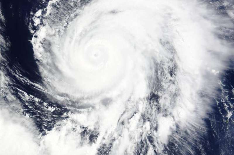
NASA sees Typhoon Nangka moving through Northwestern Pacific

NASA's Terra satellite passed over Typhoon Nangka as it was moving through the Northwestern Pacific Ocean on July 13.
When NASA's Terra satellite passed over Typhoon Nangka on July 13 at 1:40 UTC (3:25 p.m. EDT), the MODIS instrument captured a visible-light image that showed strong bands of thunderstorms spiraling into the center and a visible eye.
On July 13 at 1500 UTC (11 a.m. EDT), Nangka's maximum sustained winds were near 105 knots (120.8 mph / 194.5 kph). Nangka was centered near 21.8 North latitude and 136.9 East longitude, about 317 nautical miles southwest of Iwo To, Japan. Nangka was moving to the north at 9 knots (10.3 mph/16.6 kph). Nangka is generating very rough seas with wave heights to 45 feet (13.7 meters).
Nangka continues moving in a north-northwesterly direction and is expected to near Kyushu, southwestern Japan on by July 16.
Provided by NASA's Goddard Space Flight Center


