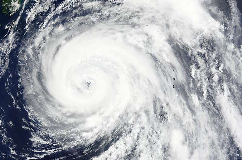
NASA sees a ragged eye in Typhoon Nangka

NASA's Terra satellite captured a visible image of Typhoon Nangka's ragged eye when it was south of Kyhshu, Japan early on July 15. Typhoon Nangka is expected to make landfall in southern Japan on July 16.
The Moderate Resolution Imaging Spectroradiometer or MODIS instrument aboard NASA's Terra satellite captured a visible image of Typhoon Nangka nearing Japan on July 15 at 01:25 UTC (July 14 at 9:25 p.m. EDT). The image showed a ragged 15-nautical-mile-wide eye surrounded by thick bands of powerful thunderstorms.
At 1500 UTC (11 a.m. EDT), Nangka's maximum sustained winds were near 80 knots (92.0 mph/148.2 kph). It was centered near 29.3 North and 135.4 East about 375 nautical miles (431.5 miles/694 km) south-southeast of Iwakuni, Japan. Nangka has tracked north-northwestward at 13 knots (15 mph/24 kph).
For warnings and watches from the Japan Meteorological Agency, visit: http://www.jma.go.jp/jma/indexe.html.
The Joint Typhoon Warning Center forecast calls for Nangka to weaken and track north-northwestward to northwestward toward Japan.
Provided by NASA's Goddard Space Flight Center


