NASA catches three days of Typhoon Hagupit's motion over Philippines

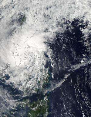
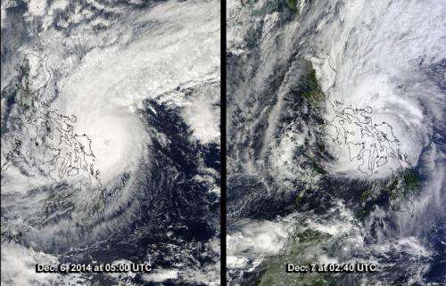
NASA's Terra and Aqua satellites flew over Typhoon Hagupit from Dec. 6 through Dec. 8 and the MODIS instrument that flies aboard both satellites provided images of the storm as it moved through the country.
The Moderate Resolution Imaging Spectroradiometer or MODIS instrument aboard NASA's Aqua satellite caught a picture of Hagupit on Dec. 6 before it made landfall. On Dec. 7, the MODIS instrument aboard NASA's Terra satellite took an image of the storm as it was making landfall in the eastern Philippines.
On Dec. 8 at 04:50 UTC (Dec. 7 at 11:50 p.m. EST) when NASA's Aqua satellite passed over the tropical cyclone again, it had weakened to a tropical storm and was located over Luzon in the northern Philippines. The image showed that Hagupit's cloud extent had grown and it covered the northern and central Philippines, extending south into Mindanao. Although the center was difficult to find in the image, it appeared that it was centered in the Sulu Sea, which lies in the middle of the Philippine islands.
On Dec. 6 at 1500 UTC (10 a.m. EST/11 p.m. local time, Manila), Tropical Storm Hagupit, known in the Philippines a Tropical Storm Ruby, had maximum sustained winds near 45 knots (51.7 mph/83.3 kph). It was centered near 13.8 north longitude and 121.3 east latitude, just 51 nautical miles (58.6 miles/94.4 km) south-southeast of Manila. It was moving to the west-northwest at 6 knots (6.9 mph/11.1 kph).
Warnings that remain in effect in the Philippines on Dec. 8 include: Public storm warning signal #2 in the following provinces: In Luzon: Metro Manila, Batangas, Cavite, Bataan, Laguna, Southern Quezon, Marinduque, Northern Oriental Mindoro including Lubang Island.
Public storm warning signal #1 remains in effect in the following provinces: Luzon: Zambales, Pampanga, Tarlac, Bulacan, Rizal, Rest of Quezon, Rest of Mindoro Provinces, Romblon. For the updated forecast from PAGASA, visit: pagasa.dost.gov.ph/index.php/tropical-cyclone/weather-bulletin-update....

Forecasters at the Joint Typhoon Warning Center project that Hagupit's current weakening trend will continue as the storm passes into the South China Sea. Once there, unfavorable atmospheric conditions of cooler, drier air will weaken the storm further. It is expected to reach Ho Chi Minh City in southern Vietnam by Dec. 11 as a depression.
Provided by NASA's Goddard Space Flight Center


