This article has been reviewed according to Science X's editorial process and policies. Editors have highlighted the following attributes while ensuring the content's credibility:
fact-checked
trusted source
proofread
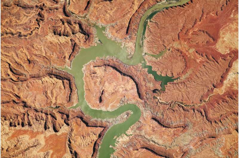
Image: Upper Lake Powell area in Utah

Erosion, tectonic uplift, and a human-built dam have all helped shape the Upper Lake Powell area in Utah.
This astronaut photograph was acquired on July 28, 2023, with a Nikon D5 digital camera using a focal length of 1,150 millimeters. It is provided by the ISS Crew Earth Observations Facility and the Earth Science and Remote Sensing Unit, Johnson Space Center. The image has been cropped and enhanced to improve contrast, and lens artifacts have been removed.
The International Space Station Program supports the laboratory as part of the International Space Station National Lab to help astronauts take pictures of Earth that will be of the greatest value to scientists and the public, and to make those images freely available on the Internet.
Additional images taken by astronauts and cosmonauts can be viewed at the NASA/JSC Gateway to Astronaut Photography of Earth.
Provided by NASA


