This article has been reviewed according to Science X's editorial process and policies. Editors have highlighted the following attributes while ensuring the content's credibility:
fact-checked
peer-reviewed publication
trusted source
proofread
Researchers develop AI model that uses satellite images to detect plastic in oceans
. DOI: 10.1016/j.isci.2023.108402")
More and more plastic litter ends up in oceans every day. Satellite images can help detect accumulations of litter along shores and at sea so that it can be taken out. A research team has developed a new artificial intelligence model that recognizes floating plastics much more accurately in satellite images than before, even when the images are partly covered by clouds or weather conditions are hazy.
Our society relies heavily on plastic products, and the amount of plastic waste is expected to increase in the future. If not properly discarded or recycled, much of it accumulates in rivers and lakes. Eventually, it will flow into the oceans, where it can form aggregations of marine debris together with natural materials like driftwood and algae.
A new study from Wageningen University and EPFL researchers, recently published in iScience, has developed an artificial intelligence-based detector that estimates the probability of marine debris shown in satellite images. This could help to systematically remove plastic litter from the oceans with ships.
Searching through satellite images with AI
Accumulations of marine debris are visible in freely available Sentinel-2 satellite images that capture coastal areas every 2–5 days worldwide on land masses and coastal areas. Because these amount to terabytes of data, the data needs to be analyzed automatically through artificial intelligence models like deep neural networks.
Marc Rußwurm, Assistant Professor at Wageningen University, says, "These models learn from examples provided by oceanographers and remote sensing specialists, who visually identified several thousand instances of marine debris in satellite images on locations across the globe. In this way, they 'trained' the model to recognize plastic debris."
Improved detection in challenging conditions
The researchers developed an AI-based marine debris detector that estimates the probability of marine debris present for every pixel in Sentinel-2 satellite images. The detector is trained following data-centric AI principles that aim to make the best use of the limited training data that is available for this problem.
One example is the design of a computer vision algorithm that snaps manual annotations from experts precisely to the debris visible in the images. With this tool, oceanographers and remote sensing experts can provide more training data examples by being less precise in the manual clicking of outlines.
Overall, this training method combined with the refinement algorithm teaches the deep artificial intelligence detection model to better predict marine debris objects than previous approaches.
Rußwurm says, "The detector remains accurate even in more challenging conditions; for example, when cloud cover and atmospheric haze make it difficult for existing models to identify marine debris precisely."
-
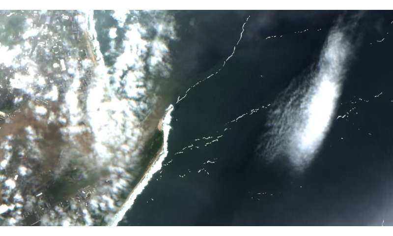
Sentinel-2 image with expert-annotations of marine debris. It shows the outwash of litter into the Indian Ocean. Credit: ESA -
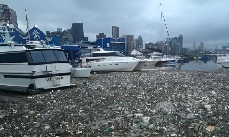
Plastic litter in the Durban Harbour. Credit: Ash Erasmus
Following plastic debris after the Durban Easter floods 2019
Detecting plastics in marine debris under difficult atmospheric conditions with clouds and haze is particularly important, as plastics are often washed into open waters after rain and flood events. This is shown by the Durban Easter floods in South Africa: In 2019, a long period of rain led to overflowing rivers, resulting in much more litter being washed away than normal.
It was taken along through the Durban harbor into the open Indian Ocean. In satellite images, such objects floating between clouds are hard to distinguish when using common red-green-blue color "channels." They can be visualized by switching to other spectral channels, including near-infrared light.
The double view reveals drift directions
Apart from more accurate prediction of marine debris aggregations, the detection model will also notice debris in daily-accessible PlanetScope images.
"Combining weekly Sentinel-2 with daily PlanetScope acquisitions can close the gap towards continuous daily monitoring," explained Rußwurm.
"Also, PlanetScope and Sentinel-2 sometimes capture the same patch of marine debris at the same day only a few minutes apart. This double view of the same object at two locations reveals the drift direction due to wind and ocean currents on the water. This information can be used to improve drift estimation models for marine debris."
More information: Marc Rußwurm et al, Large-scale Detection of Marine Debris in Coastal Areas with Sentinel-2, iScience (2023). DOI: 10.1016/j.isci.2023.108402
Journal information: iScience
Provided by Wageningen University


