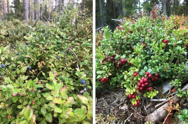
Remote sensing enables the prediction of potential berry picking locations

By combining nationwide airborne laser scanning data and data on berries collected in connection with forest inventories, it is possible to make small-scale berry yield predictions for an entire country. These predictions indicate potential berry picking locations, but do not accurately predict berry yields.
The models published now are the world's first berry yield predictions that are directly based on airborne laser scanning data. The study examined the prediction of bilberry and cowberry yields in Sweden.
In the Nordic countries, forest berries are among the most exploited non-wood forest products, with cowberry and bilberry having the highest commercial value. These berries have very different requirements for growing conditions. In the Nordic countries, berry picking comes under the right of public access, which makes it possible for everyone to pick berries for their own consumption, as well as for sale. Berry picking is also an important recreational hobby, and berries are regarded as "super food" with plenty of positive health effects. In berry picking, knowledge of good locations is key. In this study, this knowledge was generated through remote sensing.
Airborne laser scanning is a remote sensing method that produces three-dimensional data from forests. In laser scanning data, the majority of pulses are reflected from the dominant canopy, allowing its detailed description. This has enabled many applications in forest sciences, such as accurate predictions of tree stand volumes from laser scanning data. Similarly, laser scanning data has been used to predict the abundance and richness of undergrowth species, but in these cases, the indirect relation between tree stand structure and undergrowth is utilized. The study published now is also based on a similar influence relation: the laser scanning data reflects the structure of the dominant trees which, in turn, enables the prediction of the presence of berry species, and their yields.
Data on berry yields have been collected as part of the Swedish National Forest Inventory since the 2000s. In addition, a national airborne laser scanning campaign was carried out in Sweden around 2010. The researchers also utilized annual weather statistics, soil data, and satellite image interpretations of tree species. These data were used to produce generalized linear mixed-effect models to describe the annual yield of bilberries and cowberries. The most important explanatory variable in the laser scanning data was canopy cover, which reflects canopy closure. Annual yield variation was also included in the models. The models can be used to draw up maps showing potential berry picking locations. In addition, knowledge of berry yields can be utilized in multi-objective forest management.
More information: Inka Bohlin et al, Predicting bilberry and cowberry yields using airborne laser scanning and other auxiliary data combined with National Forest Inventory field plot data, Forest Ecology and Management (2021). DOI: 10.1016/j.foreco.2021.119737
Journal information: Forest Ecology and Management
Provided by University of Eastern Finland


