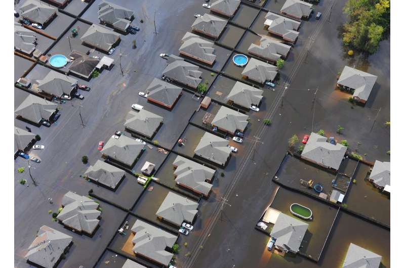
Satellite sensing may help with flooded areas

Understanding how regions are affected after a flood may be improving thanks to new research from a Florida Tech professor.
Efthymios Nikolopoulos, mechanical and civil engineering assistant professor, is working on a project funded by the National Oceanic and Atmospheric Administration (NOAA) that deals with the use of satellite remote sensing for mapping flood inundation. It involves satellite-based sensors that identify flooded areas that are validated as an algorithm through available field observations and high-resolution optical imagery from small commercial satellites analyzed by postdoctoral researcher Emanuel Storey.
Currently the team is looking at previous flood events such as the flooding that took place at the Alabama and Florida Perdido River during Hurricane Sally in 2020, as well as the flash flood in Nashville that took place March 29, leaving six dead and dozens of homes and businesses destroyed.
Initial findings are still being determined, but the team has already developed prototypes of algorithms for improving flood inundation estimation under vegetation canopy. There have been challenges, however, such as cloud coverage affecting the satellite-based sensors. The team plans to work around this by looking at other available sensors that are not affected by cloud obstruction. Nikolopoulos said the plan is to implement them later in the year.
The satellite-based flood inundation maps will give researchers a better understanding of how areas are impacted by flooding, as well as provide better insight to flood-prone areas, which could have implications for weather agencies such as NOAA and the National Weather Service, as well as the building sector.
"It's one thing for me to tell you a given river will have 1,000 cubic feet per second flow, and it's another thing to tell you it's going to be up to a meter flooded this distance adjacent to the river," Nikolopoulos said. "The translation from one to the other is not as straight forward as it may sound. We need models, and those models have errors, so we assist the development of those models through remote sensing observations."
The multi-disciplinary project has been satisfying for Nikolopoulos. The research has provided a scientific opportunity to better understand flood inundation dynamics through remote sensing, while also speaking to his engineering background through creating an immediate application that will allow for an immediate response for local officials.
In the future, Nikolopoulos would like to advance current algorithms used for flood inundation estimates, as well as better understanding where satellites perform best in relation to picking up this data. With machine learning and artificial intelligence, Nikolopoulos also sees flood inundation estimate research improving on a global scale.
"I'm really looking forward to seeing how much we can get from those sensors, and I am very optimistic about it," he said. "I think it's just the start for a very promising line of research and work overall."
Provided by Florida Institute of Technology


