Suomi NPP satellite gets night-time and infrared views of Hurricane Hector

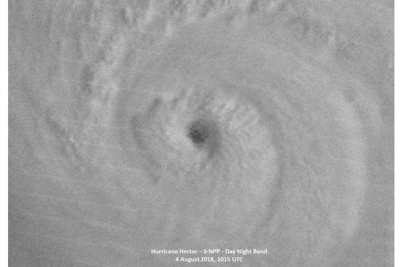
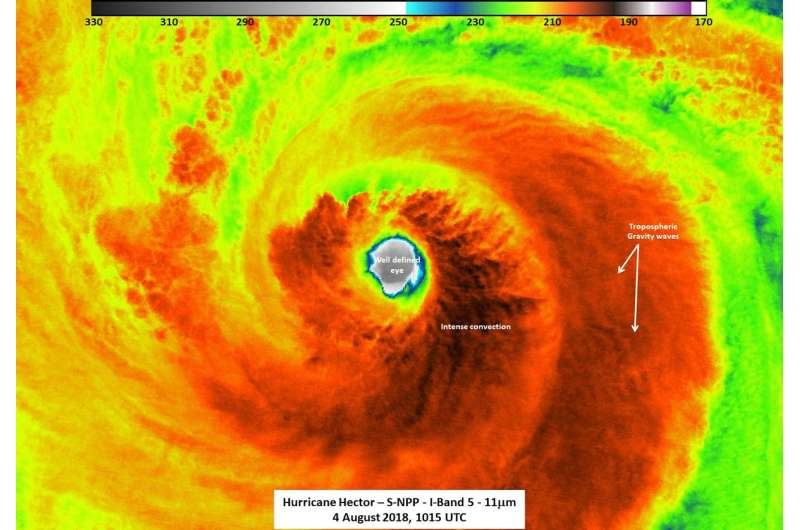
Hurricane Hector was impressive in night-time and infrared imagery taken from NASA-NOAA's Suomi NPP satellite when it strengthened into a major hurricane. Hector recently crossed from the Eastern Pacific into the Central Pacific Ocean and strengthened into a Category 4 Hurricane.
NASA-NOAA's Suomi NPP satellite provided forecasters with a night-time and infrared look at Hurricane Hector's clouds on Aug. 4 at 0300 UTC (Aug. 3 at 11 p.m. EDT) when Hurricane Hector became a major Category 3 hurricane. Hurricane Hector has maintained its strength with sustained winds of 120 mph and an estimated central pressure of 962 millibars.
William Straka III of the University of Wisconsin-Madison, Space Science and Engineering Center (SSEC) Cooperative Institute for Meteorological Satellite Studies (CIMSS), Madison, made the images. Straka said, "Suomi NPP had an almost nadir overpass of Hector, which meant that one could see the features of the storm fairly well. Not surprisingly for a major storm, there was a well-defined eye that could be seen, along with the associated tropospheric gravity waves due to the intense convection in the I05, 11um channel. The last quarter moon (53% illumination) also provided enough moonlight to see convection in the feeder bands along with the cirrus blow off and the well-defined eye from the storm. If one zooms in to the eye, as seen in the images attached, one can clearly see that it is very well defined, with open ocean being seen."

At 5 a.m. EDT 11 p.m. (0900 UTC/or 11 p.m. HST time on Aug. 5), the center of Hurricane Hector was located near latitude 14.9 North, longitude 140.6 West. That's about 1,010 miles (1,625 km) east-southeast of Hilo, Hawaii.
Maximum sustained winds are near 140 mph (220 kph) with higher gusts. Hector is a category 4 hurricane on the Saffir-Simpson Hurricane Wind Scale. Some fluctuations in intensity are expected tonight and Monday, followed by gradual weakening Monday night through Wednesday, Aug. 8. The estimated minimum central pressure is 947 millibars.
The Central Pacific Hurricane Center (CPHC) said that Hector is moving toward the west near 15 mph (24 kph) and a motion toward the west-northwest at an increased forward speed is expected through Tuesday, followed by a westward motion Tuesday night through Friday, Aug. 10.
Provided by NASA's Goddard Space Flight Center


