NASA sees a weaker Hurricane Lee headed to the UK

NASA and NOAA satellite imagery show Hurricane Lee has been on a weakening trend as wind shear is battering the storm. The National Hurricane Center expects Lee to weaken quickly and its remnants to bring gusty winds to Ireland and the United Kingdom over the weekend of Sept. 30 and Oct. 1.
NASA's Aqua satellite and NOAA's GOES satellite provided different views of Hurricane Lee that showed the storm was being adversely affected by wind shear and is not as strong and organized as it was earlier in the week.
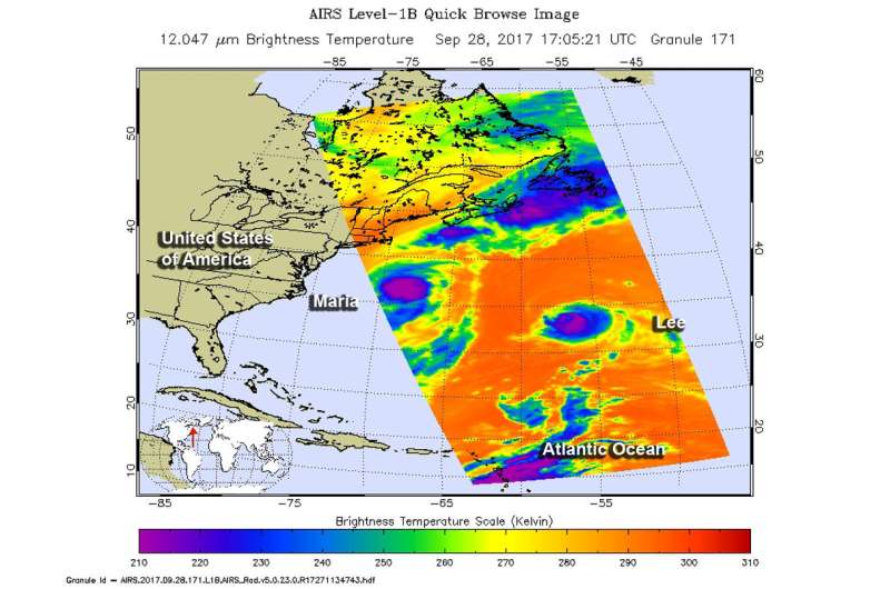
The AIRS instrument aboard NASA's Aqua satellite captured infrared data on Hurricane Lee and Tropical Storm Maria on Sept. 28 at 1:05 p.m. EDT (17:05 UTC). The infrared data was showing the strongest storms being pushed southeast of the eye.
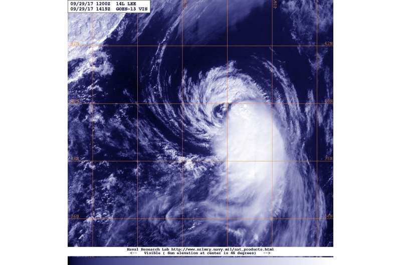
In a visible image from NOAA's GOES East satellite on Sept. 29 at 10:15 a.m. EDT (1415 UTC), wind shear's effect on the storm is evident. The National Hurricane Center said "Lee's low-level center is partially exposed along the northern edge of the convective canopy due to almost 40 knots of northerly shear." The image shows that the bulk of clouds associated with the hurricane have been pushed to the south and southeast of the eye.
At 5 a.m. EDT/AST (0900 UTC) on Sept. 29 the National Hurricane Center reported that the center of Hurricane Lee was located near 38.3 degrees north latitude and 52.4 degrees west longitude. That's about 810 miles (1,305 km) northeast of Bermuda. Lee was moving toward the northeast near 25 mph (41 kph). An acceleration toward the northeast is forecast to continue through Saturday.

NHC said "Maximum sustained winds have decreased to near 75 mph (120 kph) with higher gusts. Additional weakening is forecast, and Lee is expected to become a tropical storm later today. Lee will then dissipate by Saturday. Hurricane-force winds extend outward up to 40 miles (65 km) from the center, and tropical-storm-force winds extend outward up to 140 miles (220 km). The estimated minimum central pressure is 987 millibars."
NHC noted that global computer model guidance indicate Lee will dissipate in the fast flow ahead of an approaching cold front by 36 hours (on Sept.30 by 5 a.m. EDT). NHC said "Even after Lee's circulation opens up, a swath of strong winds will likely continue eastward toward Ireland and the United Kingdom by days 2 and 3."
Provided by NASA's Goddard Space Flight Center


