Satellite spots a tiny, mighty Hurricane Lee

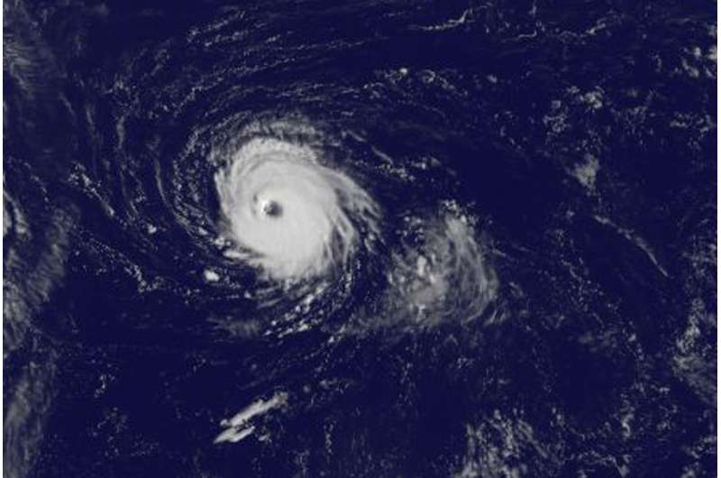
Hurricane Lee continues to strengthen in the Central Atlantic Ocean, and the tiny hurricane appeared well-organized with a clear eye in satellite imagery.
NOAA's GOES East satellite captured this visible image of tiny Hurricane Lee in the Central Atlantic Ocean on Sept. 27 at 7:45 a.m. EDT (1145 UTC). The National Hurricane Center (NHC) noted that "Conventional satellite imagery indicates that Lee has been undergoing some cloud structural changes during the past several hours. The eye has nearly doubled in size to 30 miles in diameter." Hurricane-force winds extend outward up to 30 miles (45 km) from the center, and tropical-storm-force winds extend outward up to 60 miles (95 km).
NOAA manages the GOES series of satellites and the NASA/NOAA GOES Project at NASA's Goddard Space Flight Center in Greenbelt, Md. uses the satellite data to create images and animations.
At 5 a.m. EDT (0900 UTC) on Sept. 27, the center of Hurricane Lee was located near 30.2 degrees north latitude and 56.3 degrees west longitude. That's about 520 miles (840 km) east-southeast of Bermuda. Lee was moving toward the west-northwest near 9 mph (15 kph). The hurricane is expected to turn northwestward on Wednesday and northward on Thursday, Sept. 28.
Maximum sustained winds are near 110 mph (175 kph) with higher gusts. Lee still could become a major hurricane later today before weakening commences on Thursday. The estimated minimum central pressure is 971 millibars.
For forecast updates on Lee, visit: http://www.nhc.noaa.gov
Provided by NASA's Goddard Space Flight Center


