NASA analyzes Hurricane Jose's hidden cloud-filled eye

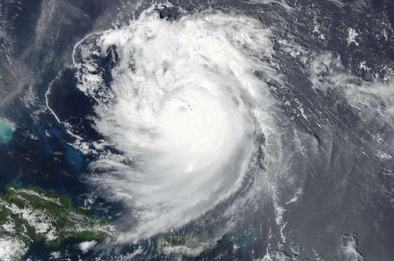
NASA satellite imagery provided a couple of views of Hurricane Jose's cloud-filled eye allowing forecasters to see that it still existed. NASA-NOAA's Suomi NPP satellite provided a visible look at the storm, while the GPM satellite provided a deeper look under the high clouds that were covering the eye.
The Visible Infrared Imaging Radiometer Suite (VIIRS) instrument aboard NASA-NOAA's Suomi NPP satellite provided a visible image of Hurricane Jose and showed that the eye had become cloud-filled eye on Sept. 10 at 1:12 p.m. EDT (1712 UTC).
On Sept. 11, the National Hurricane Center (NHC) noted "although Jose's satellite appearance is somewhat degraded due to the effects of northeasterly shear estimated to be near 25 knots it has been able to maintain persistent deep convection over the center."
NASA and the Japan Aerospace Exploration Agency's Global Precipitation Measurement mission (GPM) core satellite got a closer look at what was happening with the eye. On Sept. 11 at 12:56 a.m. EDT (0456 UTC) the National Hurricane Center said, "A GPM overpass helped to confirm that the center was on the north side of the cold cloud tops while also highlighting that an eye feature persists despite being obscured in conventional imagery."
A Temperature Check on Jose's Clouds
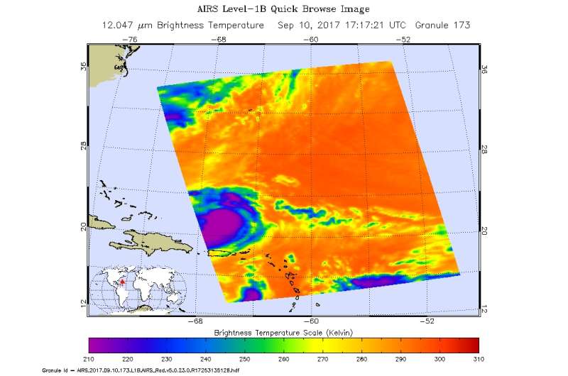
On the previous day, NASA's Aqua satellite also provided another view of the storm, measuring cloud top temperatures of clouds around and extending outward from the eye. The Atmospheric Infrared Sounder or AIRS instrument aboard NASA's Aqua satellite analyzed the storm in infrared light. Infrared light provides scientists with temperature data and that's important when trying to understand how strong storms can be. The higher the cloud tops, the colder and the stronger they are. So infrared light as that gathered by the AIRS instrument can identify the strongest sides of a tropical cyclone.

When NASA's Aqua satellite flew over Jose on Sept. 10 at 1:17 p.m. EDT (1717 UTC) AIRS detected strong thunderstorms around the eye as well as bands northeast and southeast of the center. Cloud top temperatures in those three areas were as cold as minus 63 degrees Fahrenheit (minus 53 degrees Celsius). Storms with cloud top temperatures that cold have the capability to produce heavy rainfall.
Jose's Location on Sept. 11
A 5 a.m. AST/EDT (0900 UTC) on Sept. 11, the center of Hurricane Jose was located near 24.4 degrees north latitude and 68.6 degrees west longitude. That's about 305 miles (490 km) north-northeast of Grand Turk Island.
Jose was moving toward the north-northwest near 10 mph (17 kph), and a turn toward the northeast is expected by tonight, with a reduction in forward speed. Jose is then expected to move slowly toward the east and southeast Tuesday into Wednesday, making a loop.
Maximum sustained winds were near 105 mph (165 kph) with higher gusts. Steady weakening is forecast during the next 48 hours. Hurricane-force winds extend outward up to 25 miles (35 km) from the center and tropical-storm-force winds extend outward up to 150 miles (240 km). The estimated minimum central pressure is 968 millibars.
Provided by NASA's Goddard Space Flight Center


