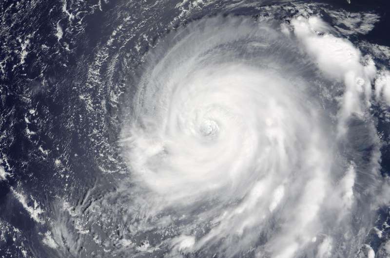
Typhoon Noru gives NASA's Terra satellite the eye

NASA's Terra satellite passed over Typhoon Noru in the Northwestern Pacific Ocean and captured a close look at the eye of the storm.
On Aug. 1 at 0150 UTC (July 31 at 9:50 p.m. EDT) the Moderate Resolution Imaging Spectroradiometer or MODIS instrument aboard NASA's Terra satellite captured a visible-light image of Typhoon Noru. The image showed that a thick band of thunderstorms continued to circle the eye, which appeared filled with high clouds. Microwave satellite data, however, provided a clearer look at the large eye and showed strong convective banding, that is, thunderstorms in bands, wrapping into the eye.
At 11 a.m. EDT (1500 UTC) on August 1, Typhoon Noru's maximum sustained winds were near 90 knots (103.6 mph/166.7 kph). The storm was centered near 24.7 degrees north latitude and 137.0 degrees east longitude. That's about 224 nautical miles west-southwest of Iwo To island, Japan. Noru was moving northwest at 7 knots (8 mph/13 kph).
Noru is moving northwest and has weakened a little. The storm's intensity is expected to fluctuate over the next 5 days, as it approaches southwestern Japan.
Provided by NASA's Goddard Space Flight Center


