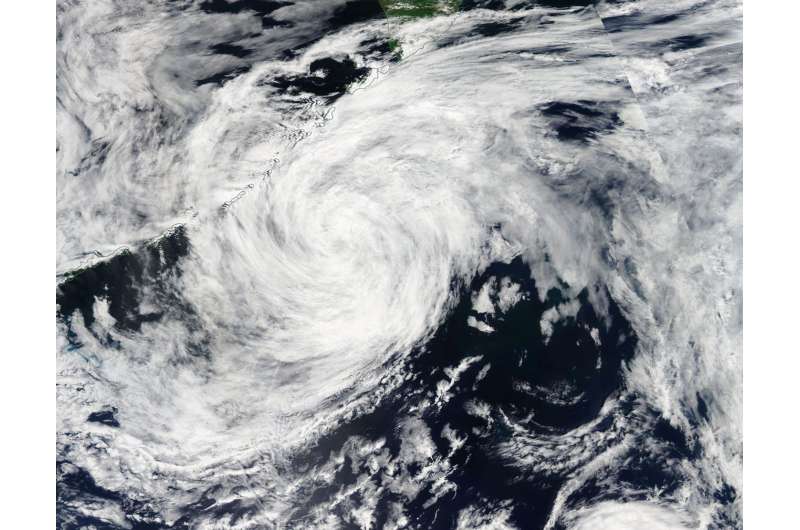
NASA Spots extra-Tropical Depression Nalgae near Kuril Islands

On August 7, NASA's Aqua satellite passed over the Northwestern Pacific Ocean and captured an image of extra-tropical storm Nalgae near the Kuril Islands north of Japan.
On Sunday, August 6 at 11 a.m. EDT (1500 UTC) the Joint Typhoon Warning Center issued their final advisory on Tropical depression Nalgae. At the time of the last advisory, Nalgae was located near 36.0 degrees north latitude and 161.4 degrees east longitude, about 805 miles north-northeast of Minami Tori Shima Atoll. Nalgae was moving to the north-northwest at 20 mph (18 knots/33 kph) and maximum sustained winds were down to 28.7 mph (25 knots/46.3 kph).
On August 7, when Aqua passed over the Northwestern Pacific Ocean, the Moderate Resolution Imaging Spectroradiometer or MODIS instrument that flies aboard captured a visible-light image of the storm. Extra-tropical storm Nalgae was just east of the Kuril Islands. The Kuril Islands of Russia's Sakhalin Oblast region are a volcanic archipelago northeast of Hokkaido, Japan that covers about 810 miles (1,300 km) and stretches to Kamchatka, Russia. The archipelago separates the Sea of Okhotsk from the North Pacific Ocean.
In the image, Nalgae had already transitioned to an extra-tropical storm, but still showed a circulation.
When a storm becomes "extra-tropical" it means that a tropical cyclone has lost its "tropical" characteristics. The National Hurricane Center defines "extra-tropical" as a transition that implies both poleward displacement (meaning it moves toward the north or south pole) of the cyclone and the conversion of the cyclone's primary energy source from the release of latent heat of condensation to baroclinic (the temperature contrast between warm and cold air masses) processes. Some cyclones can become extratropical and still retain winds of hurricane or tropical storm force, but Nalgae's winds were below 28.7 mph (25 knots/46.3 kph).
Provided by NASA's Goddard Space Flight Center


