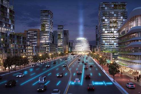
Ring roads of the future in an urban context

Electric cars that require charging and autonomous cars that can be summoned to take you from A to B. How do you take these future challenges into account in spatial planning? And what will Dutch roads and the living environment look like in 2030? In February 2016, the Professional Association of Dutch Architect's Agencies (Branchevereniging Nederlandse Architectenbureaus, BNA) and TU Delft launched a design initiative inviting design teams and the municipalities of Amsterdam, Rotterdam and Utrecht to examine five ring road locations in the respective cities. On Wednesday 15 February 2017, the resulting visions were presented at TU Delft in a new book entitled motorway x City.
In order to improve the connection between the city and motorways, and thereby improve liveability, space usage and accessibility, seven multidisciplinary design teams set to work developing visions for five ring road locations: Amsterdam Lelylaan, Amsterdam Gooiseweg, Utrecht Science Park, Rotterdam A20 and Rotterdam A13. Each team included at least one architect, landscape architect, urban planner and traffic expert from various architect's and consultancy agencies.
Roads of all types and sizes
In parallel with the design team's activities, TU Delft organised a range of education and research activities. These included a research project into the generic aspects of ring roads and the built environment. Hans de Boer, TU Delft Project Manager: 'Fransje Hooimeijer and her colleagues from the Faculty of Architecture and the Built Environment looked at the impact of future types of mobility on five types of ring road: at ground level, raised road, raised road on columns, raised road with ditch and road with ditch. They also examined how these changes would impact the neighbourhoods characterised by the 1950s (reconstruction era), the 1970s ('cauliflower' neighbourhoods, with a tree-like layout) and the 1990s (VINEX neighbourhoods, in large outer city areas). Filip Geerts explored how the road situation will change with the advent of autonomous cars (the line: the cross-section of a motorway). For example, additional space will be created adjacent to roads, because fewer traffic systems will be required. Roberto Cavallo, Valentina Ciccotosto and Manuela Triggianese focused on the space where the motorway and city meet, such as park & rides, in a historical context of technological developments, infrastructure and architecture.
Electric car charging and parking
In order to develop concrete recommendations for the future, several expert meetings were organised for the design teams and the students involved. The Netherlands Institute for Transport Policy Analysis (KiM) presented a scenario study for self-driving cars. Within TU Delft, Dimitris Milakis from the Faculty of Civil Engineering and Geosciences is studying the potential impact of self-driving cars on road capacity, car ownership and how people choose to travel. The research of Riender Happee, from the Faculty of Mechanical, Maritime and Materials Engineering, focuses on cars that drive autonomously using cameras and sensors, human-machine interaction and the interaction between autonomous vehicles and vulnerable road users. Hans de Boer: 'These academic insights, the expertise of the agencies and the expertise of the involved municipalities and regional branches of Rijkswaterstaat regarding motorways in the urban context all help to accelerate the production of compelling ideas. For example, autonomous cars could be parked under a road raised on columns, while electric cars could be charged at park & ride locations. For example, their use as a traffic junction will intensify as people will be able to switch easily from the autonomous car to the autonomous bus, such as a WEpod'.
Short-term adjustments
The study has not only contributed to a vision for the future and a strategy for how to apply this vision, it also resulted in a new working method. Hans de Boer: 'By closely examining the locations together in this way, municipalities and the regional branches of Rijkswaterstaat can identify opportunities to make short-term adjustments, and to include these in maintenance programmes. Consider, for example, improving bicycle access to the residential areas located between the A20 motorway and De Rotte river. By working together, the parties involved will be able to view the motorway in an urban context, and to make optimal use of the space. This is of particular interest to the Ministry of Infrastructure and the Environment, which was also involved in this study. With this book, which is being published in both Dutch and English, we would like to share the acquired insights and working method with other European ministries of infrastructure and the environment (Rijkswaterstaat in Dutch). These ministries have joined forces in the Networking for Urban Vitality joint venture, within which the Dutch Rijkswaterstaat is also an active partner'.
Provided by Delft University of Technology


