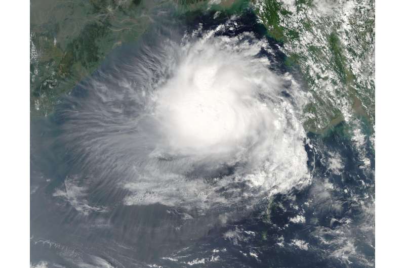
NASA's Aqua satellite sees Tropical Cyclone 3B developing in Bay of Bengal

A tropical low pressure area previously designated System 99B has been lingering in the Northern Indian Ocean's Bay of Bengal for days and as NASA's Aqua satellite passed overhead, the storm was consolidating into a tropical storm.
On Oct. 25 at 3:25 a.m. EDT (07:25 UTC) the Moderate Resolution Imaging Spectroradiometer or MODIS instrument aboard NASA's Aqua satellite captured a visible light image of Tropical Storm 3B (TS3B) as it was quickly consolidating. Strong thunderstorms with tightly curved banding was wrapping into a defined low-level circulation center. The MODIS image captured the image of TS3B just west of Burma's Ayeyarwady region.
At 5 a.m. EDT (0900 UTC) on Oct. 20, TS3B's maximum sustained winds were near 45 mph (~40 knots/75 kph). TS3B was centered near 60.7 degrees north latitude and 90.6 degrees east longitude, about 340 nautical miles south of Chittagong, Bangladesh. TS3B was moving to the west at 7 mph (6 knots /11 kph).
The Joint Typhoon Warning Center (JTWC) forecast calls for TD3B to strengthen into a tropical storm and move west across the Bay of Bengal over the next several day, making landfall north of Chennai, India sometime on Oct. 27.
Provided by NASA's Goddard Space Flight Center


