Aqua satellite sees birth of Tropical Cyclone 5S in Southern Indian Ocean

NASA's Aqua satellite flew over Tropical Cyclone 05S and captured a visible and infrared image of the depression as it formed in the Southern Indian Ocean.
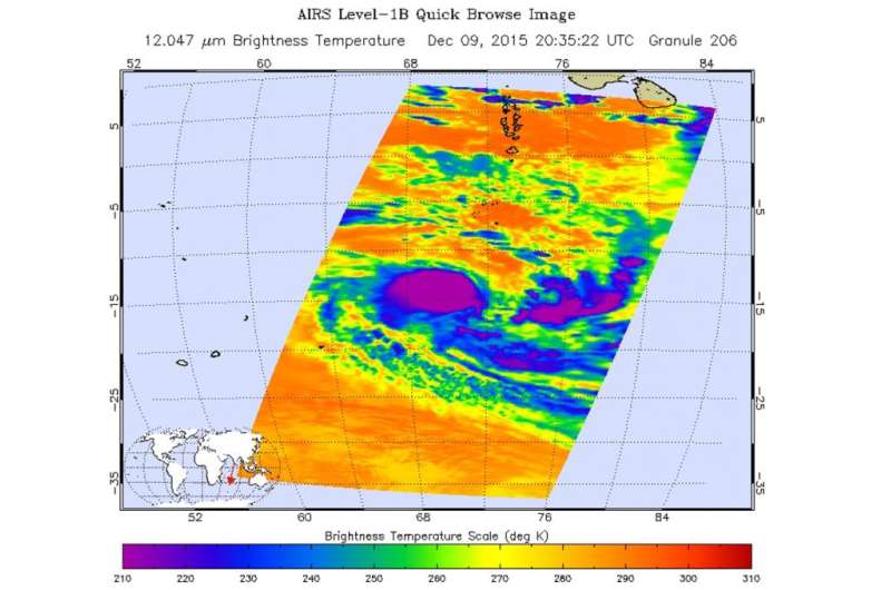
On Dec. 9 at 20:35 UTC (3:35 p.m. EST) NASA's Aqua satellite flew over System 97S as it was consolidating and developing into a depression. The Atmospheric Infrared Sounder or AIRS instrument captured infrared temperature data on TC05S that showed strongest thunderstorms with coldest cloud tops circled the center. Those thunderstorm cloud tops had temperatures as cold as minus 63 degrees Fahrenheit (minus 52 degrees Celsius). System 97S continued to consolidate and organize and by Dec. 10 became a tropical depression that intensified further into a tropical storm.
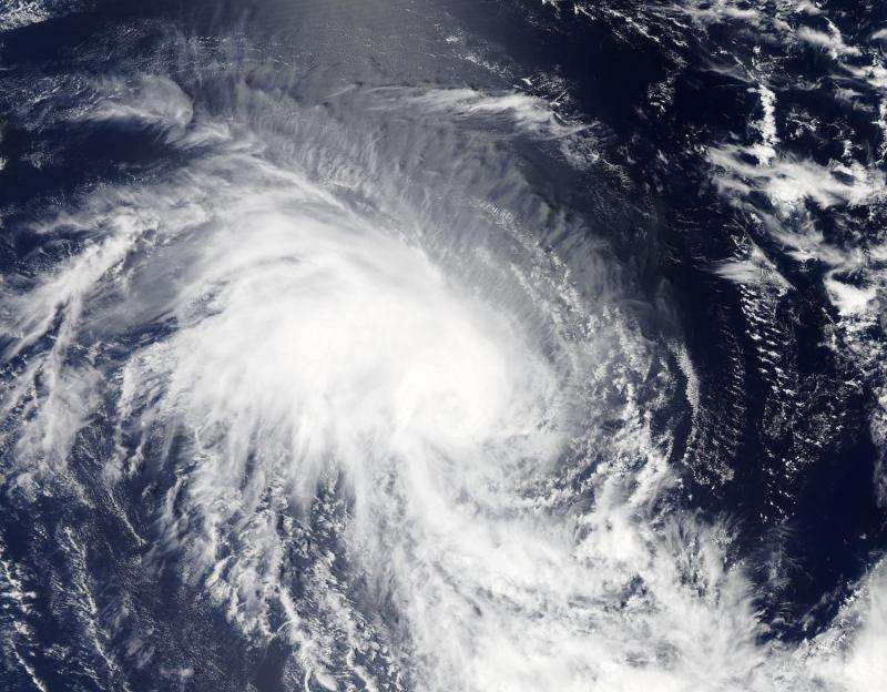
Tropical Cyclone 05S (TC5S) formed well to the south of Diego Garcia. On Dec. 10 at 08:55 UTC (3:55 a.m. EST) the Moderate Resolution Imaging Spectroradiometer or MODIS instrument aboard NASA's Aqua satellite captured an image of TC5S showing the bulk of clouds and thunderstorms circling the center. The image showed multiple bands of thunderstorms building from the southern boundary along the western half of the system into the center.
On Dec. 10 at 0900 UTC (4 a.m. EST), TC05S had maximum sustained winds near 35 knots (40 mph/62 kph). It was centered near 14.1 south latitude and 69.8 east longitude, about 439 nautical miles (505 miles/813 km) south-southwest of Diego Garcia. TC05S was moving to the west at 8 knots (9.2 mph/14.8 kph).
Forecasters at the Joint Typhoon Warning Center (JTWC) noted that TC05S has some challenges that include dry air, increasing mid-latitude westerlies (winds) and sea surface temperatures cooling below the threshold needed to maintain a tropical cyclone's strength.

Total precipitable water imagery showed a dense warm core of moisture but a thin ribbon of dry air has started to build along the northern edge of the tropical storm. JTWC noted that this dry air has not yet made it to the core, but will hinder development of thunderstorms over the next couple of days. In three days, by Dec. 13, TC05S is expected to encounter increasing vertical wind shear and cooler sea surface temperatures which will weaken the storm.
Although TC05S is forecast to pass to the east of Mauritus and La Reunion Island from Dec. 12 through 14 while moving in a southerly direction, the Joint Typhoon Warning Center noted that Rodrigues Island is expected to feel effects from the storm. Rodrigues is an outer island of the Republic of Mauritius about 348 miles (560 kilometers) east of Mauritius.
For updated forecasts from the Mauritus Meteorological Services, visit: http://metservice.intnet.mu/
Provided by NASA's Goddard Space Flight Center


