Aqua satellite analyzes Typhoon Goni

Some residents of the Philippines are under warnings as Typhoon Goni approaches from the east. NASA's Aqua satellite passed over the storm and captured visible and infrared data on the monster storm on August 19, 2015.
There are several warnings in effect in the Philippines. Public storm warning signal #2 is in effect in the Batanes Group of Islands and Cagayan including the Calayan and Babuyan Group of Islands. In addition, Public Storm Warning Signal #1 is in effect for Isabela, Kalinga, Apayao, Abra and Ilocos Norte.
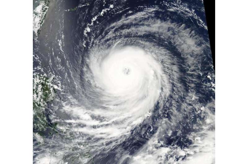
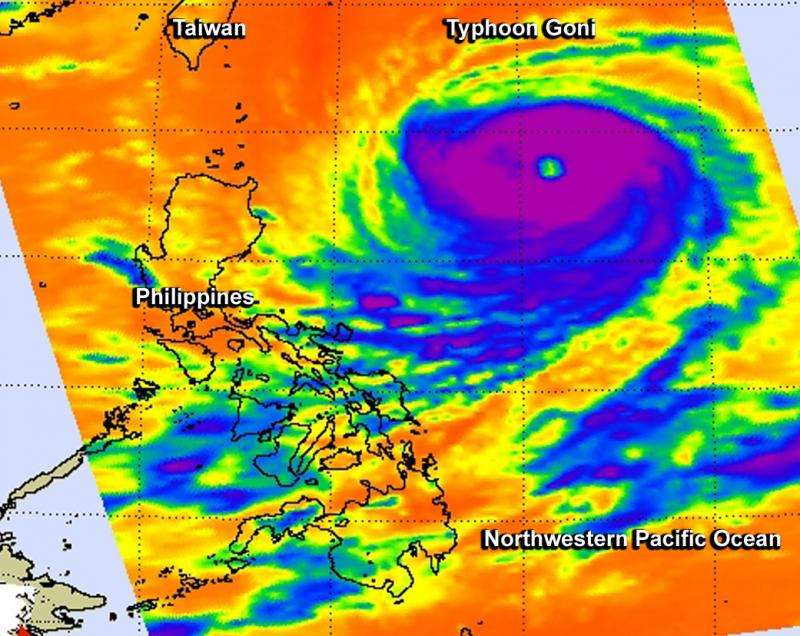
The Atmospheric Infrared Sounder or AIRS and MODIS instruments gathered data that revealed powerful thunderstorms surrounding a wide-open eye. On August 18 at 04:59 UTC (12:59 a.m. EDT) the AIRS instrument aboard NASA's Aqua satellite gathered infrared data on Goni. In a false-colored image of the data created at NASA's Jet Propulsion Laboratory in Pasadena, California, cloud top temperatures revealed cloud top temperatures as cold as 210 kelvin/-63.1F/-81.6C surrounding the eye. Cloud top temperatures that cold indicate very high, powerful thunderstorms with the capability for generating heavy rainfall.
At the same time, the Moderate Resolution Imaging Spectroradiometer or MODIS instrument that flies aboard Aqua captured a visible picture of the storm. The MODIS image showed a thick band of thunderstorms circling the open eye.
On August 19, 2015 at 1500 UTC (11 a.m. EDT) Typhoon Goni had maximum sustained winds near 125 knots (143.8 mph/231.5 kph), making it a Category 4 hurricane on the Saffir-Simpson Scale. It was centered near 18.9 North latitude and 128.4 East longitude, about 457 nautical miles (525.9 miles/846.4 km) south of Kadena Air Base, Okinawa, Japan. Goni was moving to the west at 14 knots (16.1 mph/25.9 kph).

Forecasters at the Joint Typhoon Warning Center expect Goni weaken and pass to the north of Luzon, Philippines before turning sharply north to pass Taiwan to the east.
Provided by NASA's Goddard Space Flight Center


