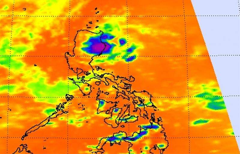
NASA sees newborn Tropical Depression 12W near northeastern tip of Philippines

When Tropical Depression 12W formed on the northeastern tip of the Philippines in the Luzon Region, NASA's Aqua satellite captured infrared data on the newborn storm.
The Atmospheric Infrared Sounder (AIRS) instrument that flies aboard NASA's Aqua satellite captured infrared data on Tropical Depression 12W. AIRS data showed some cloud top temperatures were as cold as -63F/-53C on July 23 at 5:17 UTC (1:17 a.m. EDT). Cloud top temperatures that cold have been shown to generate heavy rainfall.
Tropical Depression 12W (TD12W) formed at 0900 UTC (5 a.m. EDT) on July 23 in the Philippine Sea, Northwestern Pacific Ocean. By 1500 UTC (11 a.m. EDT), the center was off-shore from Luzon near 17.7 North latitude and 123.3 East longitude. TD12W was moving away from the Philippines in a north-northeasterly direction at 3 knots (3.4 mph/5.5 kph). TD12W had maximum sustained winds near 25 knots (28.7 mph/46.3 kph).
There were no warnings posted in the Philippines as TD12W pulled away.
Forecasters at the Joint Typhoon Warning Center forecast 12W to move to the northeast and barely intensify before it becomes wrapped up in the circulation of Typhoon Halola (which is northeast of TD12W).
Provided by NASA's Goddard Space Flight Center


