NASA's GPM sees dry air affecting Typhoon Halola

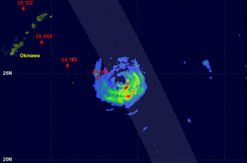
The Global Precipitation Measurement (GPM) mission core observatory passed over Typhoon Halola and saw that the northern side of the storm lacked rainfall. Dry air moving into the storm from the north was sapping the development of thunderstorms on that side of the storm.
The GPM core observatory's Microwave Imager (GMI) and Dual-Frequency Precipitation Radar (DPR) measured rainfall as it flew directly over Typhoon Halola in the western Pacific Ocean on July 23, 2015 at 1414 UTC (10:14 a.m. EDT). The southeastern side of the typhoon had the highest rainfall amounts near 40 mm (1.5 inches) per hour, while the northern side of the storm was showing less than 10 mm (0.4 inches) per hour.
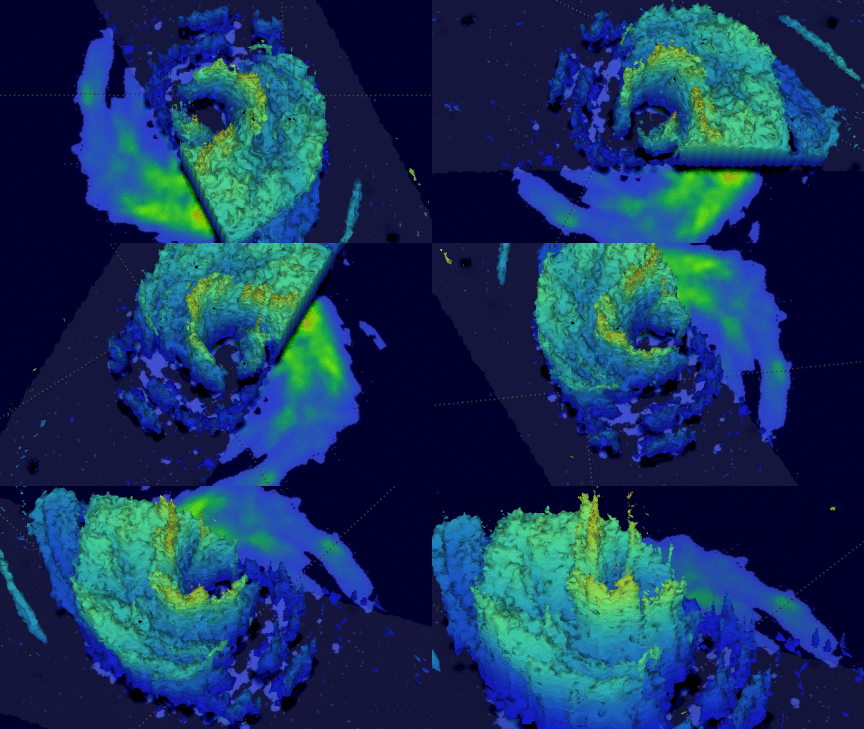
At NASA's Goddard Space Flight Center in Greenbelt, Maryland, a simulated 3-D flyby around Typhoon Halola was made from GPM Radar data (Ku Band). This animation showed that Halola's eye wall was incomplete, possibly due to dry air being transported into the center of the typhoon.
The GPM observatory is a joint partnership between NASA and the Japan Aerospace Exploration Agency.
At 1211 UTC (8:11 a.m. EDT) on July 24, Scatterometer data, that measures the speed of surface winds, showed that the storm was stretching out from east to west, with the strongest winds in the northeastern quadrant. When a storm becomes elongated, it tends to weaken. Compare a storm's circulation to a tire - if the tire is not inflated enough to make it spin properly in a circular motion, it can't spin as fast and as efficiently, just like an elongated tropical cyclone.

Since GPM flew over Halola, more dry air has been affecting the storm. The Joint Typhoon Warning Center noted on July 24, that infrared imagery showed dry air dissipating convection (rising air that forms the thunderstorms that make up a tropical cyclone) along the northern edge of the storm. There was still bands of thunderstorms around the southern and eastern quadrants of the storm, wrapping into the center of the circulation
On July 24, 2015 at 1500 UTC (11 a.m. EDT), Typhoon Halola's maximum sustained winds were down to 70 knots (80.5 mph/129.6 kph) and continues to slowly weaken. It was centered near 25.0 North latitude and 131.0 East longitude, about 195 nautical miles east-southeast of Kadena Air Force Base, Okinawa, Japan. Halola is moving to the west at 7 knots (8.0 mph/12.9 kph), and generating 23-foot-high (7.0 meter) seas.
Halola is slowly weakening as it approaches Okinawa. For updated warnings and watches from the Japan Meteorological Agency, visit: http://www.jma.go.jp/jma/indexe.html.
The Joint Typhoon Warning center forecast calls for the storm to curve to the northeast, moving past South Korea as a tropical storm, and into the Sea of Japan where it is expected to dissipate.
Provided by NASA's Goddard Space Flight Center


