All NASA eyes on Tropical Storm Dolphin

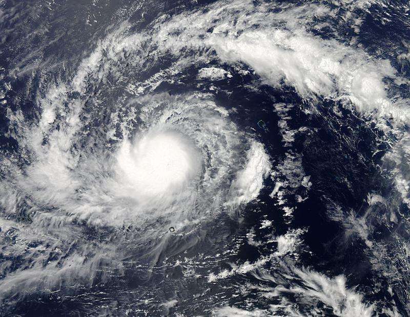
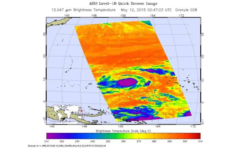
Three NASA satellite instruments took aim at Tropical Storm Dolphin. Dolphin responded by posing for pictures as it headed west towards Guam gathering strength and speed as it moves. The MODIS instrument on the Aqua satellite captured the image above on May 12, 2015. An eye was not present in this image so Dolphin still has some more developing to do. It is moving west at 7 knots. AIRS produced the image below of Dolphin on May 12, 2015 and lots of cold temps in the upper atmosphere are present and the storm is developing into a tropical cyclone.
Dolphin's current position is 757 miles east southeast of Andersen AFB on Guam and the storm has its sights on visiting the country by Friday with winds predicted to be at 80 knots (92 mph) as it rides by. Its maximum sustained winds are 50 to 65 knots (54 to 74 mph) with wave heights of up to 18 feet.
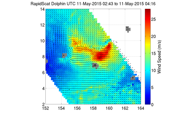
RapidScat on the International Space Station took this image of Dolphin on May 11, 2015. The image shows the very beginnings of the circular motion of the storm starting to develop, but there is no particular eye formed as yet in this image.
A tropical storm watch is in force for Fananu, Chuuk State. Residents of Ulul in Chuuk State and in the Marianas should monitor Tropical Storm Dolphin carefully.
-

The RapidScat instrument on the International Space Station took this image of Dolphin on May 11, 2015. Credit: NASA JPL, Doug Tyler -

The AIRS instrument on the Aqua satellite took this image of Tropical Storm Dolphin on May 12, 2015. Credit: NASA JPL, Ed Olson
Provided by NASA's Goddard Space Flight Center


