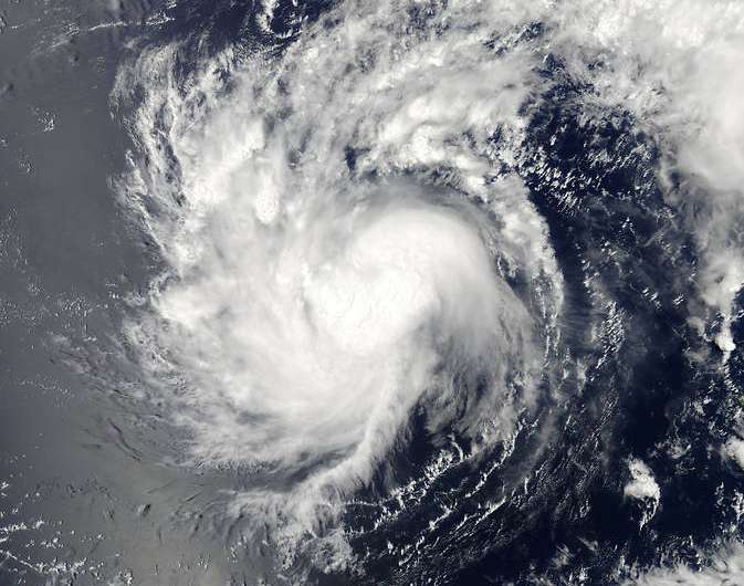
Tropical Depression Haishen moves away from Fananu

Tropical Storm Haishen has weakened and moved farther away from the island of Fananu in the Northwestern Pacific Ocean. Before Haishen weakened from tropical storm status, NASA's Aqua satellite passed overhead and captured a visible image showing the system over Micronesia.
On April 4 at 03:00 UTC, the Moderate Resolution Imaging Spectroradiometer or MODIS instrument aboard NASA's Aqua satellite captured a visible image of Tropical Storm Haishen over the Fananu and the Federated States of Micronesia. The MODIS image showed the center of the storm northwest of Fananu.
By 1500 UTC (11 a.m. EDT) on April 6, Haishen had weakened to a tropical depression with maximum sustained winds near 25 knots (28.7 mph/46.3 kph). The depression was moving to the north-northwest at 7 knots (8 mph/12.9 kph), further away from Micronesia. It was centered near 9.6 north latitude and 150.3 east longitude, about 149 nautical miles (171 miles/276 km) northwest of Chuuk.
Infrared imagery showed that there was little strong convection left in the system and most of it was being pushed away from the center by strong southwesterly wind shear. That wind shear continues to weaken the tropical depression and the Joint Typhoon Warning Center expects Haishen to dissipate in a day or two.
Provided by NASA's Goddard Space Flight Center


