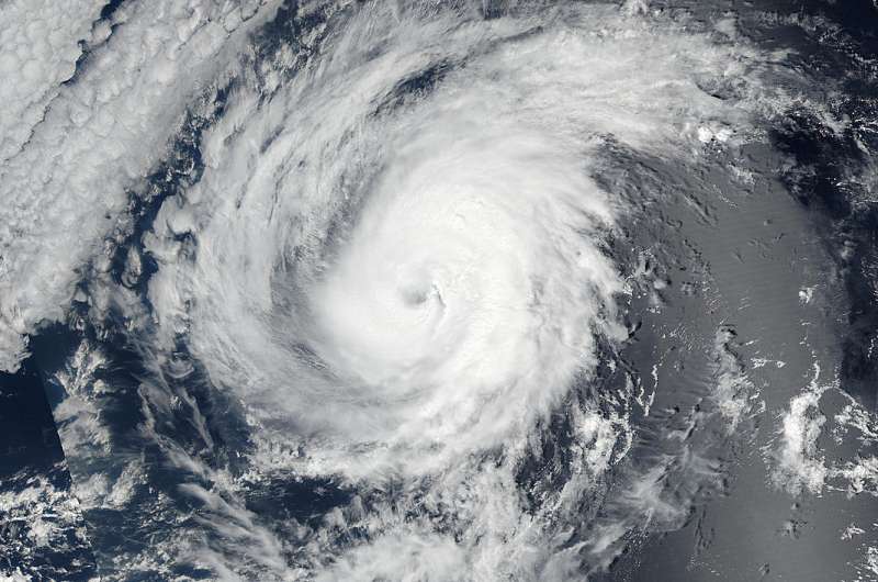
NASA sees Hurricane Orlene at peak intensity

Hurricane Orlene reached peak strength as the Suomi NPP satellite passed overhead.
On Sept. 12 at 5 p.m. EDT Orlene's maximum sustained winds reached 110 mph (175 kph) and became a Category 2 hurricane on the Saffir-Simpson Hurricane Wind Scale.
NASA-NOAA's Suomi NPP satellite passed over Orlene on Sept. 12 at 4:40 p.m. EDT (20:40 UTC). The Visible Infrared Imaging Radiometer Suite (VIIRS) instrument aboard NASA-NOAA's Suomi NPP satellite captured a visible image of the storm that showed the storm at its peak intensity with an eye surrounded by powerful thunderstorms.
In the National Hurricane Center 5 a.m. EDT discussion on Sept. 13, NHC forecaster Daniel Brown noted that "recent microwave images suggest there has been some erosion of the southern portion of the eyewall overnight, and the overall satellite presentation of the hurricane has continued to gradually degrade. The eye has become cloud filled in infrared satellite pictures and the convective tops surrounding the eye have warmed overnight."
When cloud tops warm it means they are not as high as they were in the troposphere and the uplift of air pushing them has weakened. It's a sign that the storm is weakening.
At 5 a.m. EDT (2 a.m. PDT/0900 UTC) the center of Hurricane Orlene was located near 19.2 degrees north latitude and 118.9 degrees west longitude. That's about 635 miles (1,020 km) west-southwest of the southern tip of Baja California, Mexico. Maximum sustained winds are near 105 mph (165 kph) with higher gusts. Gradual weakening is forecast during the next couple of days.
Orlene is moving toward the north near 5 mph (7 kph), and the National Hurricane Center (NHC) said this general motion with a reduction in forward speed is expected this morning. A northward or north-northwestward drift is expected later today, Sept. 13 and tonight. A turn toward the west at a faster forward speed is expected on Wednesday, Sept.14.
Because Orlene is expected to slow down during the next day and a half, it will cause cooler waters to come up (known as upwelling) from below the ocean surface. Those conditions are expected to cause gradual weakening during the next day or so because tropical cyclones need waters at least as warm as 80 degrees Fahrenheit (26.6 degrees Celsius) to maintain intensity.
Provided by NASA's Goddard Space Flight Center


