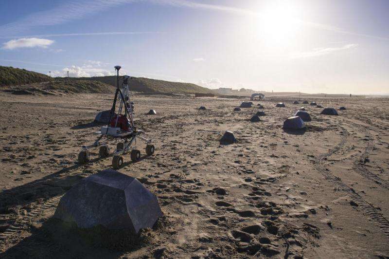
Image: Rover versus rocks

An array of strange, sharp-edged rocks appeared suddenly on a sandy beach near ESA's technical centre as part of an ambitious test of robotic rover technology.
Rovers for Mars and other destinations will operate much too far from Earth for direct teleoperation to be feasible. Instead, some level of automation is essential.
Katwijk beach, close to ESA's ESTEC technical centre in the Netherlands, was chosen to test two new sets of software for rover navigation.
"Both software routines rely on the presence of landmark features," explains Martin Azkarate of ESA's Planetary Robotics Laboratory. "The problem is that this flat, sandy North Sea beach doesn't normally have any.
"So we added 212 cardboard 'rocks' for our testbed rover to navigate around."
The new software was developed by research students Evangelos Boukas and Rob Hewitt working through ESA's Networking/Partnering Initiative, which supports spin-in applications of advanced technology for space.
One software set matches landmarks on the ground to images acquired from orbit – in this case, an overhead drone. The other applies lidar – the laser equivalent of radar – to help track the rover's motion.
The test drives took place last Thursday, 26 November, with all the rocks retrieved after the testing was over.
"Previous rover tests have ranged as far as the Canary Islands and Chile's Atacama Desert," adds Martin. "But Katwijk beach has the advantage of being a lot closer."
Provided by European Space Agency


