SMOS meets ocean monsters

ESA's SMOS and two other satellites are together providing insight into how surface winds evolve under tropical storm clouds in the Pacific Ocean. This new information could to help predict extreme weather at sea.
This year, a particularly strong El Niño is resulting in much higher surface ocean temperatures than normal. The surplus heat that is being drawn into the atmosphere is helping to breed tropical cyclones – Pacific Ocean monsters. With eight major hurricanes already, this year's hurricane season is the fifth most active in the Eastern Tropical Pacific since 1971.
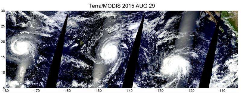
At the end of August, three category-4 hurricanes developed in parallel near Hawaii.
A collage from NASA's Terra satellite captured the Kilo, Ignacio and Jimena hurricanes beautifully.
However, a special set of eyes is needed to see through the clouds that are so characteristic of these mighty storms so that the speed of the wind at the ocean surface can be measured.
This information is essential to forecast marine weather and waves, and to predict the path that the storm may take so that mariners receive adequate warning of danger.
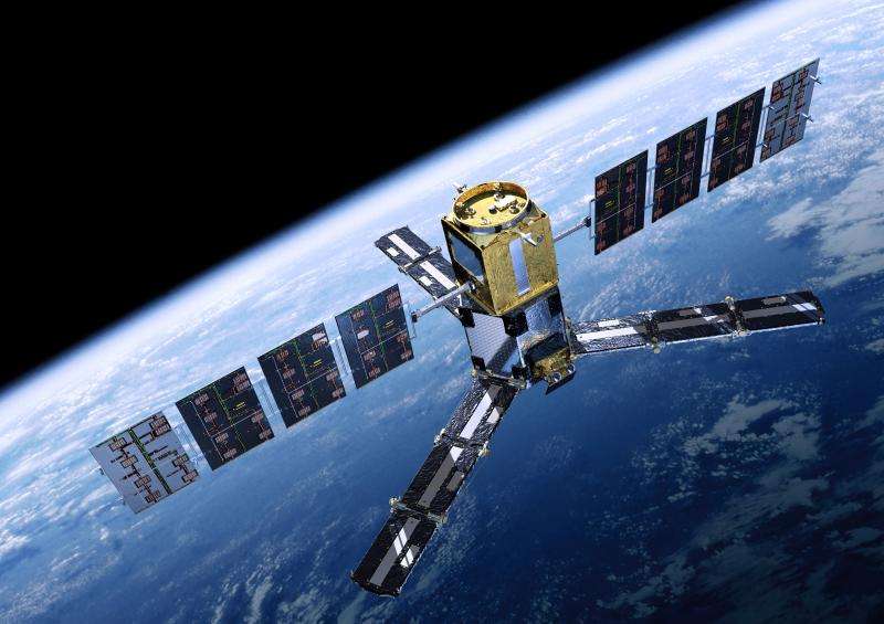
The microwave detector on SMOS yields information on soil moisture and ocean salinity. Going beyond its original scientific objectives, ESA pioneered the application of SMOS measurements to study wind speeds over the ocean.
Taking this even further, measurements from two other satellites, NASA's SMAP and Japan's GCOM-W, which carry differing low-frequency microwave instruments, are being used with readings from SMOS to glean new information about surface winds under hurricanes.
Combining data from multiple satellites in this way provides a unique view of how the surface wind speed evolves under tropical storms in unprecedented detail. This will greatly improve the information on the initial conditions of tropical cyclones fed into weather forecasting, and hence their prediction.
Scientists from Ifremer in France and the Met Office in the UK are assessing these new data and how they could be integrated into hurricane forecasting.
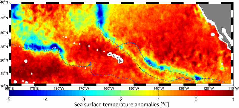
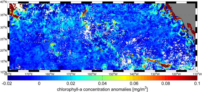
Measurements of sea-surface temperatures reveal cold-water wakes trailing the three recent hurricanes, highlighting the power these winds have in stirring the upper ocean and bringing cooler deep waters to the surface.
Interactions between the sea and atmosphere on this scale have implications for hurricane forecasting centres and for ocean forecasting systems such as Europe's Copernicus Marine Environmental Monitoring Service.

Nicolas Reul from Ifremer said, "In addition to improving marine forecasting, the combination of data from sensors on different satellites will definitively enhance our understanding of ocean–atmosphere interactions in intense storms.
"Yet the future of this type of satellite measurement remains uncertain, as follow-on missions are not guaranteed."

Craig Donlon, ESA's ocean scientist, added, "Highlighting the societal benefits of new measurement approaches and Earth observation technologies is part of our core business.
"The exciting results emerging from this project demonstrate the importance of passive microwave sensors for extreme weather prediction and for understanding air–sea interactions, and the need to study future mission concepts that combine different microwave channels on a single satellite."

Provided by European Space Agency


