Satellites see Tropical Depression 16E's landfall in northwestern Mexico

Tropical Depression 16E made landfall in northwestern Mexico on September 21 and NASA's Aqua satellite and NOAA's GOES-West satellite captured imagery of the storm that is bringing heavy rainfall.
At 5 p.m. EDT on Sunday Sept. 20, Tropical Depression 16-E (TD16E) developed off the west coast of the Baja California Peninsula.
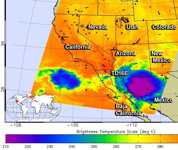
A false-colored infrared image from the Atmospheric Infrared Sounder or AIRS instrument aboard NASA's Aqua satellite showed cold cloud top temperatures (colder than -63/-53C) within TD16E on Sept. 21 at 5:35 a.m. EDT). Cloud top temperatures that cold indicate very high thunderstorms with the capability for dropping heavy rainfall.
By 11 a.m. EDT (1500 UTC) on Monday, Sept. 21, TD16E made landfall over northwestern Mexico, about 140 miles (230 km) north of Santa Rosalia, Mexico. It was centered near 29.2 North and 112.1 West at that time. Maximum sustained winds were near 35 mph (55 kph) with higher gusts. The depression was moving toward the north-northeast near 18 mph (30 kph) and this general motion is expected to continue through Tuesday.
The National Hurricane Center noted that on the forecast track, the center of the depression will continue to move across extreme northwestern Mexico and move into southern Arizona at night on Monday, September 21 or early on Sept. 22, Tuesday morning.
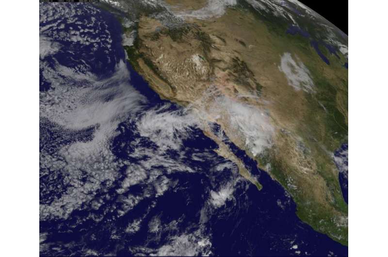
A visible image of the U.S. southwest and western Mexico was taken from NOAA's GOES-West satellite on Sept. 21 at 1745 (1:45 p.m. EDT) and showed the clouds of TD16E over northwestern Mexico.
According to NHC, the depression is expected to produce rainfall amounts of 3 to 5 inches across the northern Baja California peninsula, the northwestern Mexican state of Sonora, and Arizona and New Mexico. Isolated maximum amounts of 12 inches are possible in Baja California and Sonora, Mexico. Isolated maximum amounts of 8 inches are possible in Arizona and New Mexico. Between 1 to 2 inches of rain is expected over portions of southern California through Tuesday. This rainfall could cause life-threatening flash floods and mudslides, especially in mountainous areas.

The National Weather Service in Tucson, Arizona issued a Flash Flood Watch for Sept. 21, 2015. Storm total rainfall amounts are expected to range between 1 and 2 inches in lower elevations...with amounts in excess of 3 inches possible in some mountain locations.
Weakening is forecast and the depression will likely degenerate to a remnant low later on Monday, September 21.
Provided by NASA's Goddard Space Flight Center


