NASA sees Tropical Storm Kevin stream high clouds over Baja California

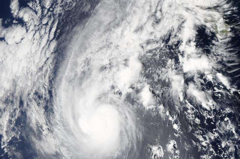
Tropical Storm Kevin's center was several hundred miles south-southwest of Baja California when NASA's Aqua satellite passed overhead and saw some associated high clouds streaming over the peninsula.
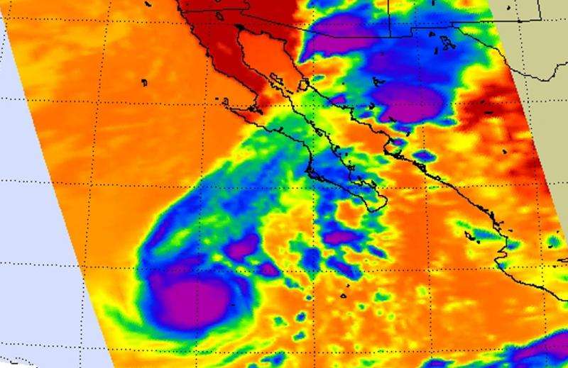
The MODIS and the AIRS instruments aboard Aqua captured visible and infrared images of Kevin on September 3 at 20:50 UTC (4:50 p.m. EDT). The visible image from the Moderate Resolution Imaging Spectroradiometer or MODIS instrument provided look at Kevin's clouds. MODIS showed a somewhat elongated tropical storm with a fragmented band of thunderstorms wrapping into the low-level center from the north.
The Atmospheric Infrared Sounder or AIRS image showed that Kevin continued to produce a cluster of convection and developing storms near its center with cloud top temperatures colder than -80 Celsius (-112 Fahrenheit).
The AIRS and MODIS satellite imagery showed high, cold, cirrus clouds were pushed northeast of Kevin's center, and streamed over Baja California. That indicates that southerly vertical wind shear was increasing over the cyclone.
At 5 a.m. EDT (0900 UTC) the center of Tropical Storm Kevin was located near latitude 20.2 North, longitude 115.8 West. That's about 420 miles (680 km) west-southwest of the southern tip of Baja California, Mexico. Maximum sustained winds were near 60 mph (95 kph). Kevin was moving toward the north near 8 mph (13 kph) and a turn to the west-northwest is expected over the next two days.
Forecaster Beven of the National Hurricane Center noted that the forecast track takes Kevin over decreasing sea surface temperatures in an environment of increasing vertical wind shear. Wind shear can tear the circulation of storms apart, so combined with the cooler ocean temperatures, those two factors should cause steady weakening later on September 4, with Kevin forecast to weaken to a depression by September 6 and a remnant low shortly thereafter.

Provided by NASA's Goddard Space Flight Center


