Two satellites see newborn Tropical Storm Jimena consolidating

NASA's Aqua satellite and NOAA's GOES-West satellite provided temperature and cloud data on newborn Tropical Storm Jimena in the Eastern Pacific Ocean. Data from both satellites show the storm continues to consolidate.
Tropical Depression 13E formed about 865 miles (1,390 km) south-southwest of the southern tip of Baja California, Mexico at 5 p.m. EDT (2100 UTC) on August 26. Six hours later, the depression strengthened into Tropical Storm Jimena at 11 p.m. EDT.
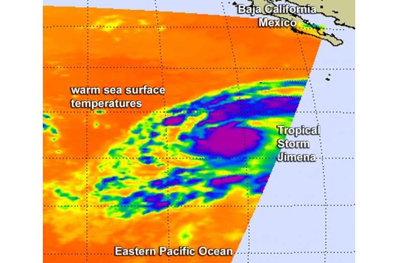
A false-colored infrared image from Aug. 27 at 09:47 UTC (4:57 a.m. EDT) showed high, cold, strong thunderstorms surrounding the center of Tropical Storm Jimena. AIRS imagery also showed a thick band of thunderstorms spiraling into the northern quadrant of the storm from the east. Coldest cloud top temperatures were as cold as -63F/-53C around the center of the tropical storm. NASA research has shown that thunderstorms with cloud tops that cold and high in the troposphere have the potential to generate heavy rainfall.
At 11 a.m. EDT on August 27, Forecaster Berg of the National Hurricane Center noted that Jimena is steadily becoming better organized with deep convection persisting near the center and more pronounced banding developing around the circulation.
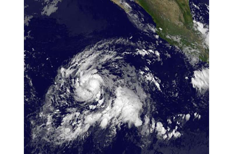
NOAA's GOES-West satellite captured imagery of Tropical Storm Jimena's clouds at 8 a.m. EDT on Aug. 27. The image showed a tight circular area of thunderstorms around the center of circulation and bands of thunderstorms from the northern and southern quadrants wrapping into the center.
On August 27 at 11 a.m. EDT (8 a.m. PDT/1500 UTC), the center of Tropical Storm Jimena was located near latitude 12.4 North, longitude 117.7 West. That's about 890 miles (1,430 km) southwest of the southern tip of Baja California, Mexico. Jimena was moving toward the west-northwest near 17 mph and is expected to turn west and slow down later in the day. Maximum sustained winds had increased to near 45 mph (75 kph). The estimated minimum central pressure is 1003 millibars.
Berg's forecast discussion noted that "rapid intensification is a distinct possibility during the next 24 hours." Jimena is forecast to become a hurricane on August 27.

Provided by NASA's Goddard Space Flight Center


