Aqua satellite sees Hurricane Dolores moving away from Mexico

NASA's Aqua satellite flew over Hurricane Dolores in the Eastern Pacific Ocean as it continued to move away from the southwestern coast of Mexico. Dolores was still a Category 4 hurricane and was generating rough surf and ocean swells.
The National Hurricane Center (NHC) noted on July 15 that "swells generated by Dolores are affecting portions of the coast of southwestern Mexico and the southern coast of the Baja California peninsula. These swells could cause life-threatening surf and rip currents."
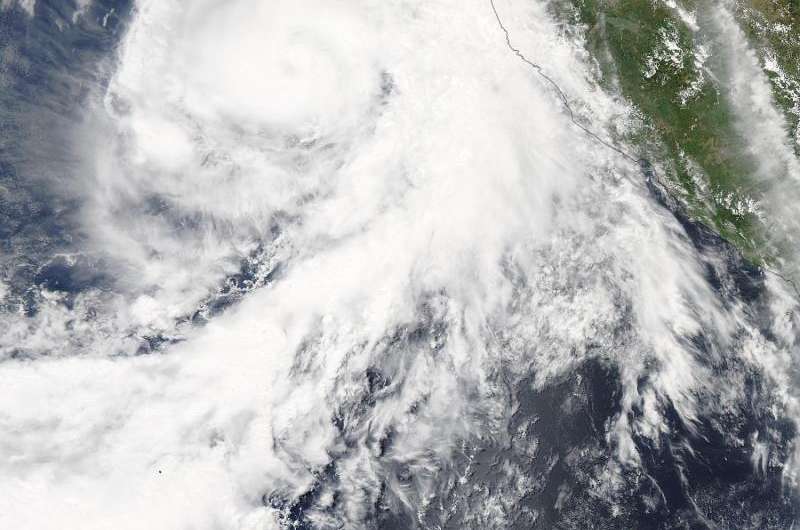
NASA's Aqua satellite passed over Dolores on July 14 at 20:20 UTC (4:20 p.m. EDT/1:20 p.m. PDT) and the MODIS instrument aboard gathered data that provided a visible picture of the storm. The image showed that the center of Dolores was well off-shore, but the eastern quadrant of the storm was still over the Mexican state of Jalisco. Bands of thunderstorms in Dolores' northwestern quadrant were just reaching Socorro Island at the time of the image.
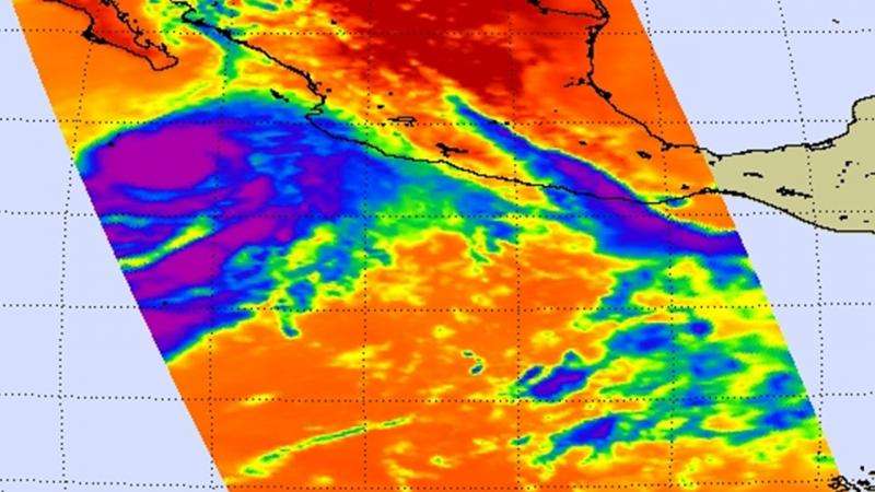
Infrared data from the Atmospheric Infrared Sounder or AIRS instrument that also flies aboard Aqua showed some warming of the convective (thunderstorm) cloud tops within the northern semicircle (hurricanes are made up of hundreds of thunderstorms). When cloud tops appear warmer it means they are lower in the atmosphere and do not have as strong an uplift. In short, it means that the thunderstorms are getting weaker.
At 11 a.m. EDT (1500 UTC) on July 15 the eye of Hurricane Dolores was located near latitude 18.4 North, longitude 110.2 West. That puts the eye about 310 miles (500 km) south of Cabo San Lucas, Mexico. Dolores was moving toward the west-northwest near 6 mph (9 kph), and this general motion is expected to continue through Thursday, July 16. A turn toward the west with some increase in forward speed could occur by Thursday night.
The NHC noted that Dolores' maximum sustained winds remain near 130 mph (215 kph) because it is in an environment with low vertical wind shear and warm waters. Dolores is a category 4 hurricane on the Saffir-Simpson Hurricane Wind Scale. Some strengthening is forecast during the night time hours on July 14, with weakening expected to begin on July 15 when Dolores runs into cooler waters and a more stable environment.

Provided by NASA's Goddard Space Flight Center


