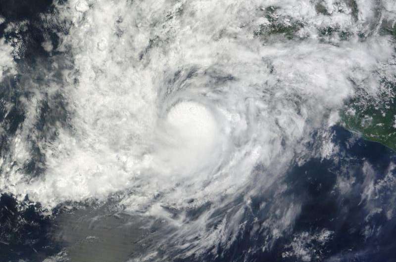
NASA sees Hurricane Carlos causing coastal complications

Hurricane Carlos has been crawling up the coast of southwestern Mexico, weakening and re-strengthening to hurricane force. NASA's Terra satellite captured an image of the hurricane as it continued to cause coastal complications for the residents of western Mexico.
On June 15 at 17:45 UTC 1:45 p.m. EDT) the MODIS instrument aboard NASA's Terra satellite captured an image of Hurricane Carlos over western Mexico. The MODIS image showed that Carlos is a compact storm with strong thunderstorms tightly circling the center. Carlos' hurricane force winds extend outward up to 10 miles (20 km) from the center, and tropical storm force winds extend outward up to 60 miles (95 km). No eye was visible in the MODIS image as it was obscured by clouds, however the eye was seen using microwave data from satellite.
On June 16, a Hurricane Watch was in effect from Punta San Telmo to Playa Perula, Mexico and a Tropical Storm Warning was in effect from Punta San Telmo to Cabo Corrientes, Mexico
At 11 a.m. EDT (1500 UTC) Carlos was a minimal Category 1 hurricane on the Saffir-Simpson Wind Scale with maximum sustained winds near 75 mph (120 kph). The National Hurricane Center (NHC) expects little change in strength over the next day with weakening to begin on June 17.
Carlos' center was located near latitude 17.5 North, longitude 104.3 West. That puts the storm's center about 105 miles (165 km) south of Manzanillo, Mexico. Carlos was moving toward the west-northwest near 5 mph (7 kph). The NHC expects Carlos to turn to the northwest later on June 16 or on June 17. The estimated minimum central pressure is 989 millibars.
Hurricane-force winds, heavy rain, inland flooding and rough surf are the complications created from Carlos being so close to the coast. The NHC noted that Carlos is expected to produce heavy rains in the Mexican states of Guerrero, Michoacan, Colima, Jalisco, Nayarit, Durango, and Sinaloa with rainfall accumulations of 3 to 6 inches possible through Thursday morning, June 18. Isolated maximum amounts of 10 inches are also possible. As always with heavy rainfall in these area, the rains may produce life-threatening flash floods and mud slides, especially in areas of higher terrain.
The southwestern coast of Mexico continues to experience ocean swells and those are expected for the next few days. These swells could cause life-threatening surf and rip currents.
On the forecast track, Carlos should move parallel to and just offshore of the southwestern coast of Mexico over the next couple of days. For updates on Carlos' strength, position and forecast, visit the NHC website: http://www.nhc.noaa.gov.
Provided by NASA's Goddard Space Flight Center


