Forecasters look higher to make better cold weather predictions

Jan 18, 2013
Forecasters look higher to make better cold weather predictions

(Phys.org)—As Britain shivers through another spell of snow and ice, new research could help weather forecasters predict when such cold snaps are likely to occur.

Professor Ted Shepherd, an expert on the at the University of Reading, is co-author of a research paper published this week that helps to confirm the value of studying what's going on high up in the atmosphere to help predict the we are likely to see at the surface.

Weather forecasts mainly focus on the - the lower layers of the atmosphere from the earth's surface up to around 10km - as that is where most of our weather comes from.

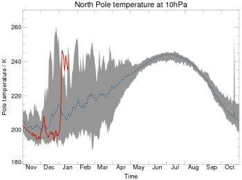
However, scientists are increasingly learning that changes to the upper layers of the atmosphere, such as the stratosphere, can have a significant effect on our weather. In a paper published in Nature Geoscience, Professor Shepherd, working with colleagues in Toronto, Canada, where he worked prior to coming to Reading, found evidence that detecting sudden increases in temperatures, high up over the Arctic, was a good indicator that people in Britain and northern Europe could paradoxically expect a big freeze.

The researchers found that these 'stratospheric sudden warming' events were more helpful than had previously been thought in helping forecasters provide better winter forecasts, and could help to predict a in Britain and several weeks ahead.

Professor Shepherd said: "It is well known that stratospheric sudden warming events can affect weather for a period of up to two months.

"The issued recently by a number of weather centres predict that Britain will be about 1 degree centigrade colder than average through to the end of February. That might not sound like a lot but averaged over a month it makes quite a difference.

"Our research has shown how a sudden warming high in the stratosphere can add extra skill to wintertime seasonal forecasting - which, evidence shows, had previously been very difficult to get right. Our work shows that we can have more confidence in seasonal winter predictions when these high atmosphere warming events occur."

Explore further: Met Office model to better predict extreme winters

More information: Sigmond, M. et al., 'Enhanced seasonal forecast skill following stratospheric sudden warmings', Nature Geoscience (2013) doi:10.1038/ngeo1698

add to favorites email to friend print save as pdf

Related Stories

Cold winters caused by warmer summers, research suggests

Jan 12, 2012

Scientists have offered up a convincing explanation for the harsh winters recently experienced in the Northern Hemisphere; increasing temperatures and melting ice in the Arctic regions creating more snowfall in the autumn ...

Ozone layer faces record 40 pct loss over Arctic

Apr 05, 2011

(AP) -- The protective ozone layer in the Arctic that keeps out the sun's most damaging rays - ultraviolet radiation - has thinned about 40 percent this winter, a record drop, the U.N. weather agency said ...

Recommended for you

Second Atlantic season tropical depression forms

7 hours ago

Tropical Depression 2 formed in the western Caribbean Sea during the early afternoon hours (Eastern Daylight Time) on June 17. NOAA's GOES-13 satellite captured an image of the storm as it consolidated enough ...

NASA image: Bushfires in north of Western Australia

15 hours ago

According to the Australian Government Bureau of Meterology, "In the warm, dry and sunny winter and spring, when grasses are dead and fuels have dried, northern Australia becomes most susceptible to bushfires. ...

User comments : 2

Adjust slider to filter visible comments by rank

Display comments: newest first

Jeddy_Mctedder
1 / 5 (3) Jan 18, 2013
As an amateur meteorologist who always has focussed on the gaps in the macro understanding of the sphere and its cooling mechanism its fairly clear that radiation and depressurization of atmospheric gasses at high lattitude is where the vast bulk of heat of earth is 'lost' to space. [the last being electrostatic eruptions upward like sprites] .We rarely talk about how difficult it is to study this part of the atmosphere by its very nature.

It is to thin to provide bouyancy let alone lift and it is far to thick for perpetal freefall (orbitting)
One can only pass through it with a rocket and even then you change your immidiate surroundings by depositing your exaust into the local space which you are trying to study.

Its time we start facing our inability to adequately studdy this space.
Sherrin
1 / 5 (1) Jan 24, 2013
The editor (or perhaps the author) has not explained how a sudden stratospheric warming event is linked to a cold spell in Boris Johnson's backyard. Or is it? Is this article saying that when such a sudden event occurs, then it is reasonable to predict warmer surface weather?

More news stories

Predators affect the carbon cycle, researchers show

A new study shows that the predator-prey relationship can affect the flow of carbon through an ecosystem. This previously unmeasured influence on the environment may offer a new way of looking at biodiversity management and ...

Final curtain for Europe's deep-space telescope

The deep-space telescope Herschel took its final bow on Monday, climaxing a successful four-year mission to observe the birth of stars and galaxies, the European Space Agency (ESA) said.

New language discovery reveals linguistic insights

A new language has been discovered in a remote Indigenous community in northern Australia that is generated from a unique combination of elements from other languages. Light Warlpiri has been documented by University of Michigan ...