This article has been reviewed according to Science X's editorial process and policies. Editors have highlighted the following attributes while ensuring the content's credibility:
fact-checked
trusted source
proofread
The surprising secrets of extreme snowfall events in Utah's central Wasatch

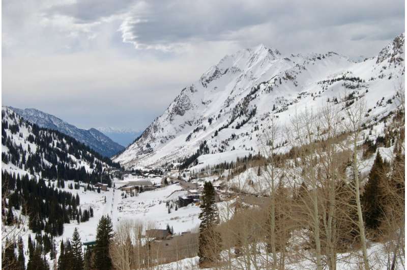
Major snowstorms in Utah's Wasatch Mountains are both a blessing and a curse. They deliver much-needed moisture that supplies water to the state's biggest metropolitan area and fluffy light snow to support the world's finest powder skiing.
But heavy snowfall also wreaks havoc on canyon roads and creates extreme avalanche hazards that can sometimes shut down busy winter recreation sites. Alta at the head of Little Cottonwood Canyon, for instance, can be reached by vehicle only via a winding road that rises 3,000 feet in 8 miles, crossing about 50 avalanche paths.
University of Utah atmospheric scientists have set out to better understand extreme snowfall, defined as events in the top 5% in terms of snow accumulations, by analyzing hundreds of events over a 23-year period at Alta, the famed ski destination in the central Wasatch outside Salt Lake City.
The resulting study, published in Monthly Weather Review, illustrates the remarkable diversity of storm characteristics producing orographic snowfall extremes in the ranges of the Intermountain West.
The orographic effect occurs when air is forced to flow up and over mountains, which cools the air and condenses its water vapor.
Some of the new findings surprised researchers. For example, they looked for an association between heavy snow and a weather factor called "integrated vapor transport," or IVT, but found a complicated relationship.
"IVT is essentially a measure of the amount of water vapor that is being transported horizontally through the atmosphere," said lead author Michael Wasserstein, a graduate student in atmospheric sciences. "In certain regions high IVT can produce extremely heavy precipitation. That can be the case for the Wasatch, but not always."
In the West Coast's Sierra Nevada and Cascade Range, by contrast, there is a stronger relationship between high-IVT storms blowing in from the Pacific and extreme precipitation and snowfall.
Spanning the years 2000 to 2022, the study analyzed a total of 2,707 snow events, each covering a 12-hour period. The average amount of snow deposited during each event was 11.2 centimeters (4.4 inches), while the median amount was just 7.6 (3 inches). Alta ski patrollers did much of the data collection at the monitoring station located near the ski area's Wildcat Lift.
The researchers homed in on "extreme" events above the 95th percentile, or 138 storms in which 30.5 centimeters (12 inches) or more snow fell. "Those would be snowfall rates of about an average of an inch an hour," said Jim Steenburgh, the study's senior author.
The biggest 12-hour accumulation was 65 centimeters (26 inches), recorded on March 30, 2005. They also examined "extreme" water-equivalent snowfall events above the 95th percentile, or 116 storms with at least 27.9 mm (1.11 inches) of water-equivalent precipitation. The water equivalent of precipitation measures the amount of water in the snowfall and is important for water resources and avalanches.
The researchers found the storm systems reaching Utah that carried relatively little water vapor were still capable of dropping heavy snows as they passed over the central Wasatch. And it wasn't just a result of Utah's notorious "lake effect," snowfall associated with moisture getting extracted off the Great Salt Lake, according to Steenburgh, a professor of atmospheric sciences.
IVT is measured in terms of kilograms of water moving a meter each second.
"IVT is one of the ways that we identify atmospheric rivers," said Steenburgh, noting an IVT value of 250 qualifies as an atmospheric river, like the one pounding Southern California this week. "And the higher the IVT, the more extreme the atmospheric river is."
Steenburgh is affectionately known around campus and Utah's ski community as Professor Powder because of his intimate knowledge of the meteorological factors behind the Wasatch Mountains' famous snow.
"We rarely get true atmospheric river conditions at Alta," he said. "We might get an atmospheric river that decays upstream, and by the time it gets here, the IVT values are below the minimum threshold."
Even in the driest of winters, Alta still receives ample snowfall with seasonal totals almost always exceeding 300 inches and averaging more than 500 inches.
"If you go to the Sierra, most of their big snowfall events are big atmospheric river events," Steenburgh said. "But at Alta, some of their biggest snowfall events are relatively low IVT events. They are incredibly efficient at producing snowfall."
Researchers found such events occur regardless of which way the wind is coming from, although colder snowstorms with fluffy snow tend to come from either the west-northwest or the northwest. In contrast, snowstorms with the highest water content within the new snow tend to come from the south-southwest or west-northwest.
The researchers attributed this to shadowing from the Stansbury and Oquirrh ranges to the west, as well as the Wasatch's "three-dimensional" topography resulting from its sub-ridges fingering off its north-south crest that capture upslope flow from a variety of directions.
Future research is needed to better understand how the complicated multi-age topography of Great Basin's mountain ranges affects precipitation processes.
More information: Michael L. Wasserstein et al, Diverse characteristics of extreme orographic snowfall events in Little Cottonwood Canyon, Utah, Monthly Weather Review (2024). DOI: 10.1175/MWR-D-23-0206.1
Provided by University of Utah


