This article has been reviewed according to Science X's editorial process and policies. Editors have highlighted the following attributes while ensuring the content's credibility:
fact-checked
peer-reviewed publication
trusted source
proofread
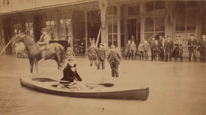
An 1867 Washington deluge shows the region's potential for flooding

An 1867 flood in western Washington surpassed anything that the region has seen in the last century, new University of Oregon research shows, offering a foreboding look at what storms fueled by climate change could now produce.
In that long-ago flood, an atmospheric river combined with snowmelt to deliver record amounts of precipitation over a three-day period. The event provides a pre-industrialization benchmark for what flooding in Washington's modern urban corridors could now look like, the researchers reported Dec. 19 in the journal PLOS Climate.
The finding suggests that future floods, now with the amplifying effects of climate change, could be even bigger and more destructive.
Flooding events such as that one are only expected to intensify in coming years. Atmospheric rivers, plumes of moisture-rich air that bring soaking rainstorms, are a major driver of flooding and have been increasing in intensity and frequency since the 1950s.
"This wasn't necessarily the record-setting event at individual sites, but when you factor in the regional impact, it's the largest event in terms of area affected," said Dan Gavin, a UO geographer who led the study alongside UO climate scientist Patrick Bartlein and professor Cary Mock of the University of South Carolina, who earned his doctorate at the UO.
The 1860s were a particularly wet time on the west coast of the United States. A cold period known as the Little Ice Age was ending, and mountain glaciers were receding as global temperatures rose. A major flood in 1861–62 is well documented as the most severe in the history of Oregon and California.
But Washington, not yet a state, was relatively sparsely populated at the time, so data on historical flooding is limited.
"We have these meteorological records that are pretty scattered, but nobody had put them together," Gavin said.
He and his colleagues sifted through microfilm records and decoded handwritten notes to hunt for flooding events. They compiled data from rain gauges at military forts around southwestern Washington, including sites near Astoria and Vancouver and along the Puget Sound.
A four-day stretch of extreme rainfall in December 1867 stood out. At Astoria, more than 12 inches fell over four days, while more than 8 inches fell at Fort Vancouver, Washington. Other stations recorded similar, though slightly lower, totals. Overall, conditions were wetter than any time in the modern record, including this fall's atmospheric river event in the Pacific Northwest.
To estimate the flooding impact, Gavin and his colleagues looked through historical newspaper articles that described the damage. They found a few reports recording the height of the water relative to structures of the time, which they could overlay on modern topography to estimate flood height. At some spots, floodplains appear to be under more than a meter of water.
While the flood swept away livestock, destroyed bridges, and wiped out towns like Monticello along the Cowlitz River, no deaths were recorded, Gavin said. Today a flood of that magnitude could be far more destructive in the densely populated corridor between Portland and Seattle. Gavin compares the 1867 event to major floods that happened in the area in 1996, which shut down parts of Interstate 5.
Regardless of whether atmospheric rivers continue to increase in frequency in a warmer world, Bartlein said, "a warmer atmosphere will also be a wetter atmosphere, and moisture is fuel for large storms."
When scientists talk about how much climate change has happened, it's often tied to a benchmark of the late 1800s, before humans began burning fossil fuels to power the world.
"These floods in the 1860s were fueled without the boost recent storms have from our warming oceans," Gavin said, "showing the potential for events more extreme than have occurred in recent history."
More information: Daniel G. Gavin et al, Historical archives reveal record rainfall and severe flooding in December 1867 resulting from an atmospheric river and snowmelt, western Washington, USA, PLOS Climate (2023). DOI: 10.1371/journal.pclm.0000324
Journal information: PLOS Climate
Provided by University of Oregon


