This article has been reviewed according to Science X's editorial process and policies. Editors have highlighted the following attributes while ensuring the content's credibility:
fact-checked
peer-reviewed publication
trusted source
proofread
Novel tool informs land use and nutrient control in troubled waters

In watersheds degraded by runoff of nutrients from farmland, land managers struggle to pinpoint the best locations to install riparian buffer strips along streams or other pollution-reduction practices, but a new technology devised by Penn State scientists promises to make the search for those sites easier and less expensive.
A cross-disciplinary team of researchers in the College of Agricultural Sciences has developed a computer model that can simulate the underground and overland movement of water—and, consequently, that of nutrients such as nitrogen and phosphorus or pollutants—in entire watersheds with far greater spatial resolution than previous hydrologic models.
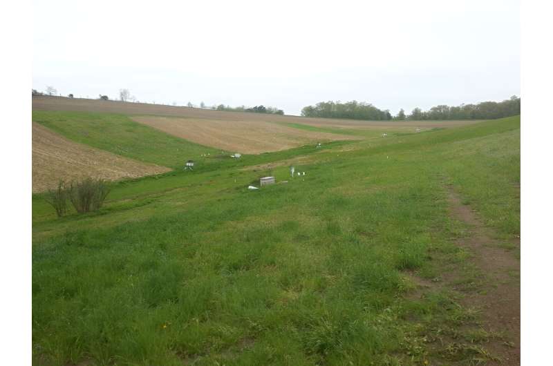
In a new study, the researchers tested their model, called Cycles-L, at an 1,800-acre (nearly 3 square miles) experimental watershed within the Mahantango Creek drainage in central Pennsylvania. They published their findings in Water Resources Research.
The potential of Cycles-L—with the "L" standing for landscapes—is remarkable, according to team leader Armen Kemanian, professor of production systems and modeling. Capable of simulating water flows and feedback loops among land, streams and groundwater, the new model accounts for the influence of topography, soil characteristics and land-management practices. It can accurately simulate horizontal and vertical transport of pollutants with water, he explained.
"Cycles-L enables users to change variables such as land use and crops and 'see' how the transport of nutrients is affected, showing where interventions such as riparian buffers and cover crops or other practices should be installed," he said. "Unlike models that simulate processes in one field without considering what the neighboring fields are doing, Cycles-L can represent every field in a watershed, a true virtual representation of a watershed suitable for in-silico [conducted by computer modeling] experiments that are not viable in the field."
It's a huge leap forward, according to Kemanian, whose research group has focused on climate-friendly agriculture over the last decade.
"Now, we can simulate how water moves underground and over land, from a forest to a field, from a field to a forest, from a field to another field, to a buffer strip and into a stream, or from the stream back to groundwater," he said. "Everything is connected, and therefore, the feedbacks among components become emergent properties. Essentially, with this 3D model, we are representing reality with a lot more fidelity."
Hopefully, the technology will be used by land managers and environmental regulators to increase productivity and anticipate and incentivize mitigations in water pollution stemming from agriculture, noted Yuning Shi, associate research professor in the Department of Plant Science. Shi spearheaded the Cycles-L code development, combining an earlier, less capable version of the Cycles model with the Penn State Integrated Hydrologic Model, previously developed by Penn State scientists.
The team calibrated the model using stream discharge data, crop-yield data and nitrogen-water-quality data collected by the U.S. Department of Agriculture's Agricultural Research Service team from the Pasture Systems and Watershed Management Research unit.
"Cycles-L can become a central component in tools for climate-change-scenario analysis, precision agriculture, precision conservation and artificial intelligence-based decision-support systems," he said. "Because it couples biogeochemical and hydrologic processes, the new model offers a unique opportunity for research that is relevant to simulate the effect of interventions in agricultural landscapes realistically."
In their journal article, the researchers reported that the Cycles-L model applied to a watershed of the Susquehanna River basin confirmed its potential. In that watershed, Cycles-L simulated surface water and ground water flow, mineral nitrogen discharge and grain yield more accurately than a one-dimensional model with no landscape connectivity.
Interestingly, the researchers said, Cycles-L indicated that denitrification—the loss of nitrogen in the form of nitrate as nitrous oxide from soil and groundwater into the air—is almost twice as high in the experimental sub-watershed when simulated with Cycles-L than when simulated with a one-dimensional model. The model could also identify the areas of high emission, enabling spatial targeting of mitigation practices.
The enhanced computer simulation could greatly aid in finding which locations are most suitable for installing buffer strips or other practices to reduce nitrogen losses, said Felipe Montes, associate research professor in the Department of Plant Science and co-author of the paper.
"Now we can explore and test potential locations with computer modeling before running costly experiments in the field," Motes said. "Furthermore, Cycles-L's spatial resolution allows modeling independent fields at the farm level, demonstrating to farmers the effect of management practices downstream in the watershed. This is important when watershed management plans are developed, because farmers can 'see," virtually, the effect of their efforts to improve water quality—increasing their commitment to the management plan."
The model's ability to represent the influence of topography, soil heterogeneity and crop management on nitrogen flows over both time and space expands the scope of agroecosystem analysis to landscape levels, the researchers said. They said they foresee tools such as Cycles-L evolving into indispensable components of the analytical toolkit for both academic and non-academic communities.
More information: Yuning Shi et al, Cycles‐L: A Coupled, 3‐D, Land Surface, Hydrologic, and Agroecosystem Landscape Model, Water Resources Research (2023). DOI: 10.1029/2022WR033453
Journal information: Water Resources Research
Provided by Pennsylvania State University


