This article has been reviewed according to Science X's editorial process and policies. Editors have highlighted the following attributes while ensuring the content's credibility:
fact-checked
peer-reviewed publication
trusted source
proofread
Isotope database will help Mexican communities better understand hydrology processes

With a population of 127 million and a land mass about a fifth the size of the United States, Mexico has a large spectrum of climates and landscapes, ranging from mountains to coastal regions and from deserts to glaciers. Because of these variations, it is important for communities to understand precipitation patterns to plan appropriately for weather events and water resources management.
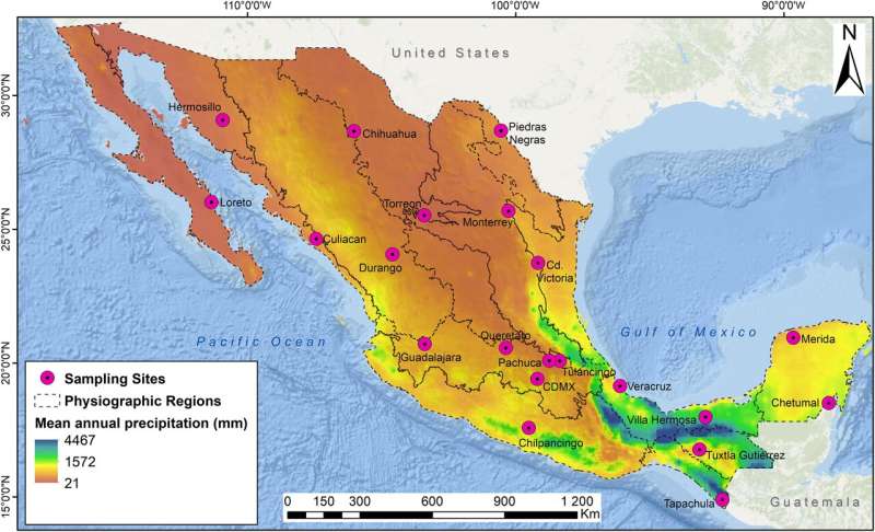
A team led by Ricardo Sánchez-Murillo, associate professor of Earth and environmental sciences at The University of Texas at Arlington, has created a new isotope database that includes 608 monthly rain samples (spanning 2018–22) from 21 monitoring stations across the country. The results of his work are published open access in the journal PLOS Water. Co-authors are from the Mexican Institute of Water Technology in Mexico City; the International Atomic Energy Agency in Vienna, Austria; and the Universidad de Vigo in Ourense, Spain.
For decades, most studies have relied on data archives from two stations in the Global Network of Isotopes in Precipitation that operated in Mexico from 1962–88. One station was in the city of Chihuahua (northern arid region); a second was in the city of Veracruz (southeastern wet region).
This represents a relatively low number of monitoring stations for such a large and heterogeneous country, with abundant rain in the south and scarce precipitation in the north. Mexico has rain forests, vast deserts, tropical and mid-latitude climates, an enormous plateau bounded by two mountain ranges where ice caps are still present, and coastlines facing the Pacific Ocean, Gulf of Mexico, Gulf of California and Caribbean Sea, Sánchez-Murillo said.
Similarly, Mexico is affected by multiple climatic features, such as the influence of cold fronts, atmospheric rivers, easterly waves, tropical cyclones and northerly trade winds. All these topographic, geographic and weather characteristics are represented in a large spectrum of climatic regions across Mexico, he said.
The authors report on the spatial and temporal isotope variations of 21 precipitation monitoring stations across different physiographic units of Mexico. These stations are part of the National Network of Isotopes in Precipitation operated by the Department of Hydrology of the Mexican Institute of Water Technology.
"Our results fill a recognized historical gap in the precipitation isotope monitoring in North America," Sánchez-Murillo said. "This will provide a baseline for other researchers to pursue more detailed ecohydrological, climatic, forensic, archaeological and paleoclimate studies across Mexico."
More information: Ricardo Sánchez-Murillo et al, Tracing isotope precipitation patterns across Mexico, PLOS Water (2023). DOI: 10.1371/journal.pwat.0000136
Journal information: PLOS Water
Provided by University of Texas at Arlington


