September 26, 2023 feature
This article has been reviewed according to Science X's editorial process and policies. Editors have highlighted the following attributes while ensuring the content's credibility:
fact-checked
peer-reviewed publication
trusted source
proofread
AI predicts sea surface temperature cooling during tropical cyclones

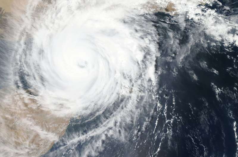
Tropical cyclones are extreme weather events, characterized by a circular form and formation over warm tropical oceans experiencing low atmospheric pressure, high winds and heavy rain. Tropical storms exceed 39 miles per hour (mph), while hurricanes experience sustained winds of 74mph and above.
The warm waters fuel the continuation of the cyclone, consequently cooling the surface of the ocean, and high wind speeds increase currents. The latter results in mixing of the layers of the ocean, bringing deeper and cooler water to the surface. In doing so, this can help to reduce the warm water fuel to cyclones, causing them to slow down or even cease altogether.
New research published in Geophysical Research Letters has turned towards technology to model the effects of tropical cyclones on oceans, in particular sea surface temperatures. This is important as the temperature can impact wider ecosystem responses, as well as the organisms that call the oceans home.
The machine learning-based random forest method used data from a 20-year period beginning in 1998 to train the system and help predict the evolution of sea surface temperature over time and space within the northwest Pacific Ocean (equator to 30°N, 100–160°E), one of the most active zones for tropical cyclones.
Doctoral researcher Hongxing Cui, of the Southern Marine Science and Engineering Guangdong Laboratory in China, and colleagues used 12 characteristics of tropical cyclones and pre-storm conditions to predict sea surface cooling in the Pacific Ocean basin.
These characteristics include: cyclone intensity, the speed and direction (translation) at which the cyclone is moving, shortest radius of cyclone reaching speeds of 30 knots, longitude and latitude of tropical cyclone epicenter, mixed layer depth, sea surface height, sea surface temperature, ocean temperature at 75m depth and changes in current speed. Of the aforementioned, tropical cyclone intensity, translation speed and size, pre-storm mixed layer depth and sea surface temperature were found to have the most significant impact on the subsequent surface temperature patterns observed in the ocean.

The random forest method model was trained with historical data from 627,400 tropical cyclones occurring between 1998 and 2018 and considers tropical cyclone activity from the three days preceding the event to 14 days after it has passed through.
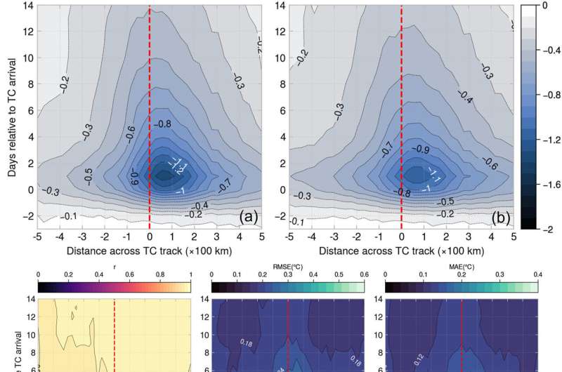
The research team observed cooling to begin in the two days prior to the event, intensifying during the passage of the tropical cyclone, but actually peaking the day after the event, with >1.3°C decline in sea surface temperature (reaching 2°C for category 3–5 hurricanes).
Over the same period the cooling expands to affect a larger proportion of the ocean surface also, though maximum cooling was found to occur offset to the direct track of the tropical cyclone, 50km to the right. By days two to four there was a relatively rapid warming of the oceans as they began returning to normal conditions, with slower recovery thereafter to day 14 when the cooling effect was reduced to just 0.4°C above the local average.
In summary, stronger intensity, larger and slower-moving tropical cyclones in areas with a shallow mixed ocean layer tend to have a greater cooling effect on the surface waters. Storm intensity and speed have a greater local effect, while the overall size of the cyclone, pre-storm ocean mixed layer depth and sea surface temperature impact the cooling effect over a larger area.
Comparing the real data outputs with predictions from the random forest method, the research team found good correlation between the results and therefore have confidence in the machine learning ability of the model for future tropical cyclone events. This can consequently be used to model effects in other ocean basins globally and help to ascertain the impact of tropical cyclones on the productivity of primary producers in the oceans, such as photosynthesizing algae, which form the basis of the complex food webs comprising the ocean's ecosystems.
More information: Hongxing Cui et al, Predicting Tropical Cyclone‐Induced Sea Surface Temperature Responses Using Machine Learning, Geophysical Research Letters (2023). DOI: 10.1029/2023GL104171
Journal information: Geophysical Research Letters
© 2023 Science X Network


