Western US 'megafloods' during last ice age might not have been so mega

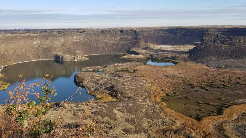
After the Last Glacial Maximum in North America, a kilometer-thick ice dam at the toe of a glacier failed, allowing the waters of massive Lake Missoula to rush out and inundate the landscape of what is now eastern Washington. The flooding carved out the scarred and pockmarked landscape of the Channeled Scablands, which cover about 30,000 square kilometers of the northwestern United States. Noted first by Indigenous flood stories and then by geomorphologists in the 1800s, the possibility of massive floods here has long been intriguing; more recently, researchers have turned to the Scablands for insights into Martian flooding, too. But geologists still don't know quite how big the Scablands floods were.
Lehnigk and Larsen turned to the largest of the Scablands' valleys, Grand Coulee in eastern Washington, for an answer. To start, they didn't look to water; they looked to rock.
Some of the valleys are a peculiar shape; rather than twisting and narrow, they are long and straight, with a uniform width. That shape is thanks to the geometric columns of basalt that make up the bedrock.
"You can only maintain that shape, really, if you're toppling stacks of columns over, so the water is coming over a waterfall," like Dry Falls, a 3.5-mile-long (5.6-kilometer-long) precipice at the head of the Lower Grand Coulee, said author Karin Lehnigk, a Ph.D. candidate in geosciences at the University of Massachusetts Amherst. "Eventually, it knocks columns at the edge of the waterfall over, and the waterfall retreats back."
Lehnigk trekked around Grand Coulee measuring the size and density of these massive basalt columns. Back in the lab, she set about modeling different flood sizes as they washed over reconstructed, preflood topography in an attempt to reconcile the geological evidence with hydrological constraints. She looked for floods big enough to reach high-water marks on the valley walls and tested whether those floods could knock over basalt columns.
Lehnigk and Larsen found that a series of smaller floods that hit far below the high-water marks on today's postflood topography could have done the job and that considering ancient topography is key.
"Imagine your bathtub," Lehnigk said, "and how much water it takes to fill it up to the rim. But if your bathtub is full of rocks," like the valley would have been prior to flooding, "you don't need as much water to reach the edge." The high-water marks, then, matter only when you consider where the canyon floor was, too.
Flood size estimates that use modern topography and rely on the valley's high-water marks overestimate the discharge by more than 80%, the researchers found. When the floodwaters began to flow and cut into the ground, the canyon's floor would have been shallower, with relative high-water marks abandoned as the waterfall marched itself back upstream through erosion.
The study not only improves our understanding of how the Scablands formed; it also can help estimate how much water once flowed to create Mars's landscapes, which is critical for knowing what past climates on the Red Planet were like. For flood channels on Mars that likely formed in the same way, such as those in Ares Vallis and Kasei Valles, similar approaches could be used to estimate their paleoflow as well, said Lehnigk.
More information: K. E. Lehnigk et al, Pleistocene Megaflood Discharge in Grand Coulee, Channeled Scabland, USA, Journal of Geophysical Research: Earth Surface (2021). DOI: 10.1029/2021JF006135
Provided by American Geophysical Union
This story is republished courtesy of Eos, hosted by the American Geophysical Union. Read the original story here.


