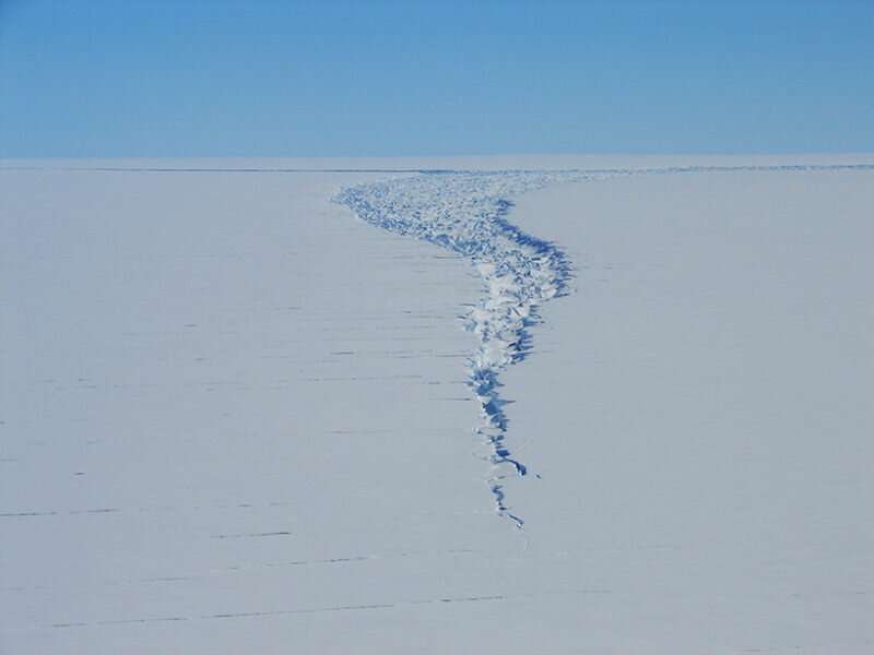
Satellite captures detaching iceberg in near-real time

NASA's ICESat-2 satellite recorded the cleaving of a 315-billion-ton iceberg from Amery Ice Shelf in 2019, as well as years of subtle cracking and splitting prior to the calving event.
In September 2019, nearly a year to the day after NASA launched its Ice, Cloud, and land Elevation Satellite–2 (ICESat-2), iceberg D-28, nicknamed "Molar berg," separated from Amery Ice Shelf in East Antarctica. The split was the first major calving event on the ice shelf since around 1964, and it released a 210-meter-thick, 315-billion-ton iceberg into the Southern Ocean. The NASA satellite, which provides a detailed look at Earth's surface from an altitude of 600 kilometers, captured the entire event. This was the only large calving event to occur in the first 2.5 years of the satellite's mission (the second, from Brunt Ice Shelf, occurred this past February).
Ice shelves surround the Greenland and Antarctic Ice Sheets, and form where the ice sheets meet the ocean. The ice shelves expand as the ice sheets collect snowfall, and dwindle as the sheets melt or calve. Most large ice shelves are in equilibrium and experience significant mass loss only through large calving events, which typically occur once every few decades. Because these events are infrequent, they attract attention, but are in fact a normal process.
In a new paper, Walker et al. describe the D-28 calving event as seen through the lens of ICESat-2. The satellite provided before, during, and after observations as a massive chunk of Antarctica's third-largest ice shelf detached and drifted into the sea. The occasion provided an unprecedented look at a calving ice shelf with data captured by a modern, high-resolution satellite.
ICESat-2 revealed subtle topographic changes on the ice shelf that were not visible in high-resolution images captured by other Earth-observing satellites, like Landsat 8 and WorldView-3. The data showed subtle topographic signatures of active rifts on the ice shelf including uplifted flanking walls, expanding crevasses, and significant acceleration in one rift just 12 days prior to calving. The observations suggest that the iceberg had been tearing away from the ice shelf from its base, hidden from view, for several years preceding the split.
The ICESat-2 data extend an unbroken chain of satellite observations of the Amery Ice Shelf rift system that stretch back to 2002. The 18-year time series shows the progression of cracks and crevasses on the shelf for nearly two decades before the 2019 calving event.
D-28 is currently floating offshore of Antarctica's Enderby Land, nearly 1,000 kilometers west of its origin. Meanwhile, ICESat-2 will continue to monitor the progression of Amery Ice Shelf in its new state. Its data will offer insights into the newly exposed ice shelf and will continue to be particularly useful for tracking the dynamic ice sheets of Greenland and Antarctica for years to come.
More information: Catherine C. Walker et al. A High Resolution, Three‐Dimensional View of the D‐28 Calving Event From Amery Ice Shelf With ICESat‐2 and Satellite Imagery, Geophysical Research Letters (2021). DOI: 10.1029/2020GL091200
Journal information: Geophysical Research Letters
Provided by American Geophysical Union
This story is republished courtesy of Eos, hosted by the American Geophysical Union. Read the original story here.


