New biomass map to take stock of the world's carbon

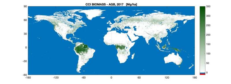
The first of a series of global maps aimed at quantifying change in carbon stored as biomass across the world's forests and shrublands has been released today by ESA's Climate Change Initiative at COP25—the United Nation Climate Change Conference currently taking place in Madrid.
As plants grow, they remove carbon dioxide from the atmosphere and store it as biomass. This is then released back to the atmosphere through processes such as deforestation, disturbance or wildfires. Assessing these dynamic changes is key to understanding the cycling of carbon and also for informing global climate models that help predict future change.
Tracking biomass change is also becoming increasingly important as decision-makers work towards the Global Stocktake—an aspect of the global Paris climate deal—that will periodically check international progress towards meeting emissions reduction commitments to limit global warming.
The new map uses optical, lidar and radar data acquired in 2017 and 2018 from multiple Earth observation satellites, and is the first to integrate multiple acquisitions from the Copernicus Sentinel-1 mission and Japan's ALOS mission.
Introducing data from these satellite's sensors improves the accuracy of forest biomass detection across different biomes, and is a significant advance on the previous 2010 map generated by the GlobBiomass project.

Richard Lucas, who manages the research project team that developed the map, comments, "Much of the carbon in forests is stored in the rainforests of the wet tropics but the new map shows that biomass is widely distributed across other biomes, particularly the dry tropics, subtropics and boreal zones."
"All of these biomes are experiencing unprecedented changes associated with human activities, which are being exacerbated by climate change. Knowing how much carbon these forests hold and how this has changed—and is changing—is a major step towards ensuring their long-term future and addressing climate change."
The next step for the research team is to develop a map covering the 2018-19 period and to quantify changes between years.
Richard explains, "A key strength of the maps derived from satellite observations is that they provide a globally consistent approach. Repeated and consistent measurements from space helps to track change in biomass distribution and density over time, and in turn informs policies that promote carbon emission reduction and forest conservation initiatives such as the United Nations Reducing Emissions from Deforestation and Degradation programme."
The global above-ground biomass map is freely available from the Climate Change Initiative's Open Data Portal.
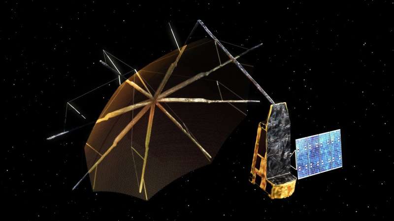
Reflecting on the importance in understanding the dynamics of the world's forest carbon store, ESA plans to launch a new Earth Explorer Biomass mission in 2022. The mission will carry the first P-band synthetic aperture radar, whose data will enable even more accurate maps of tropical, temperate and boreal forest biomass and will witness at least eight growth cycles in the world's forests during its operational lifetime.
Provided by European Space Agency


