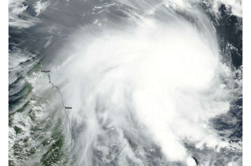
Suomi NPP satellite catches development of Tropical Cyclone 12S

Tropical Cyclone 12S has developed east of the African island nation of Madagascar. NASA-NOAA's Suomi NPP satellite passed over the Southern Indian Ocean and captured a visible image of the newly formed storm that has triggered a warning for Rodrigues, an outer island of the Republic of Mauritius.
On Feb. 5, 2019, the Visible Infrared Imaging Radiometer Suite (VIIRS) instrument aboard NASA-NOAA's Suomi NPP satellite captured visible image of Tropical Cyclone 12S. VIIRS imagery showed powerful thunderstorms wrapping into the low-level center from a large, thick band of thunderstorms spiraling in from the southern quadrant of the storm. Outer clouds from the western quadrant were just brushing the northeastern coast of Madagascar.
At 10 a.m. EDT (1500 UTC) on Feb. 5 the center of Tropical Storm 12S was located near latitude 15.8 degrees south and longitude 64.3 degrees east. That's about 492 nautical miles (566 miles/912 km) east-northeast of Port Louis, Mauritius. Maximum sustained winds are near 35 knots (40 mph/65 kph) with higher gusts. The Joint Typhoon Warning Center expects continuous strengthening and 12S is expected to reach hurricane-force by Feb. 7. It is expected to reach peak intensity near 105 knots (121 mph/194 kph) in three days.
A tropical cyclone warning class 1 is in force at Rodrigues. For local forecasts from the Mauritius Meteorological Service, visit: http://metservice.intnet.mu/.
12S is moving southwestward and is forecast to turn to the southeast and move away from Mauritius and La Reunion Islands.
Provided by NASA's Goddard Space Flight Center


