Satellite sees Supertyphoon Yutu's eye pass over Tinian

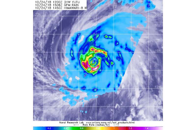
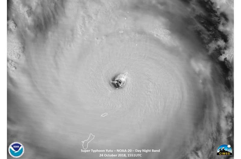
On Oct. 24, the National Weather Service or NWS in Tiyan, Guam issued the warning that "Catastrophic winds for Tinian and Saipan are imminent" as the eye of Super typhoon Yutu neared both islands. NASA-JAXA's GPM satellite and NOAA's NOAA-20 satellite provided a look at the heavy rainfall and the structure and eye of the storm. Maximum sustained winds in the eye wall are 180 mph or stronger making Yutu a dangerous category 5 super typhoon.
At 10:22 a.m. EDT (1422 UTC) on Oct. 24 or 12:22 a.m. CHST (local time) on Thursday, Oct. 25, the NWS noted "Typhoon warnings remain in effect for Rota, Tinian and Saipan. The strongest winds will occur over the next few hours at Tinian and Saipan. The winds will be much stronger than in Typhoon Soudelor!"
In addition, a Tropical Storm Warning remains in effect for Guam, Alamagan, Pagan, and Agrihan. Typhoon conditions are expected through late this morning (CHST time) at Rota,Tinian and Saipan. Tropical storm conditions are expected for Guam through this evening (CHST time). Tropical storm conditions are expected at Alamagan, Pagan, and Agrihan around midnight tonight through late Thursday evening (CHST time).
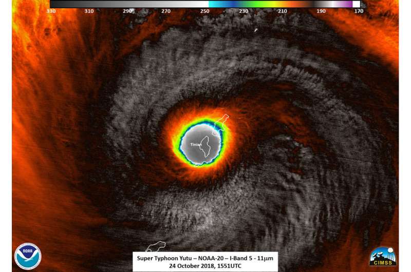
Shortly before the NOAA-20 satellite overpass on Oct. 23 (EDT) at 11:51 a.m. EDT (1551 UTC), Super typhoon Yutu hit Tinian Island, one of the three principle islands of the Northern Mariana Islands, just south of Sapian and a U.S. Commonwealth. Tinian is one of the three principal islands of the Commonwealth of the Northern Marianas. The southern part of Saipan was also impacted as well, where Saipan International Airport is located. A NOAA-20 infrared image showed coldest storm top temperatures around the eyewall at 210 kelvin (minus 81.6 Fahrenheit/minus 63.5 degrees Celsius) where storms are dropping extremely heavy rainfall.

NASA and the Japan Aerospace Exploration Agency's GPM or Global Precipitation Measurement mission core satellite provided a look at heavy rainfall occurring in Super Typhoon Yutu on Oct. 24 at 10:50 a.m. EDT (1450 UTC) as it was battering Tinian and Saipan in the Northwestern Pacific Ocean.
At 11 a.m. EDT (1500 UTC) on Oct. 24 (1 a.m. CHST Oct. 25) the center of Super Typhoon Yutu will be located near Latitude 14.8 degrees North and Longitude 145.7 degrees East. That's about 15 miles south-southeast of Tinian. Yutu is moving northwest at 13 mph. The eye of Yutu will pass over Tinian over the next couple hours. Maximum sustained winds have increased to 180 mph. Super Typhoon Yutu is a very dangerous Category 5 storm.
Typhoon force winds extend outward from the center up to 85 miles. Tropical storm force winds extend outward from the center up to 240 miles to the northeast and up to 205 miles elsewhere.

NWS said about storm surge and storm tide: Combined seas between 30 and 40 feet near the center of the storm will continue through tonight...resulting in deadly surf conditions. Coastal inundation of 15 to 20 feet is possible on windward exposures. Once Yutu passes to the west of the Mariana Islands...west and southwest swell will build with surf rising to 12 to 16 feet along west facing reefs. Coastal inundation of 5 to 7 feet is possible on west facing exposures. Surf will generate deadly rip currents.
A flash flood warning remains in effect for the entire area. Additional rainfall amounts of 6 to 10 inches are possible today. Isolated total rainfall amounts of up to 15 inches are possible.
Provided by NASA's Goddard Space Flight Center


