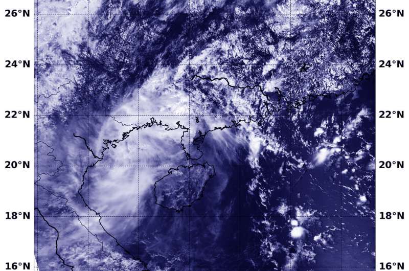
NASA-NOAA satellite finds Barijat crossing Gulf of Tonkin

Tropical Cyclone Barijat appeared disorganized on satellite imagery as it moved across the Gulf of Tonkin, South China Sea. Barijat is being torn apart and had weakened from wind shear. After a landfall on Sept. 13, it is expected to dissipate quickly.
The Gulf of Tonkin is a body of water located off the coast of northern Vietnam and southern China.
In general, wind shear is a measure of how the speed and direction of winds change with altitude. Winds at different levels of the atmosphere pushed against the cylindrical circulation center and skewed it, weakening the rotation.
Barijat weakened from a tropical storm to a tropical depression today, Sept. 13.
At 1:54 a.m. EDT (0554 UTC) on Sept. 13, the Visible Infrared Imaging Radiometer Suite (VIIRS) instrument aboard NASA-NOAA's Suomi NPP satellite analyzed Tropical Storm Isaac showed a disorganized storm with little thunderstorm development. The Joint Typhoon Warning Center noted "Convection (rising air that form the thunderstorms that make up a tropical cyclone) has all but dissipated and remnant upper level clouds are sheared to the southwest of the low level circulation center."
On Sept. 13 at 11 a.m. EDT (1500 UTC) Barijat's maximum sustained winds had dropped to 28.7 mph (25 knots/46.3 kph). It was located approximately 129 nautical miles east of Hanoi, Vietnam. Barijat is moving westward and is expected to make landfall in Vietnam where it will dissipate on Sept. 14.
Provided by NASA's Goddard Space Flight Center


