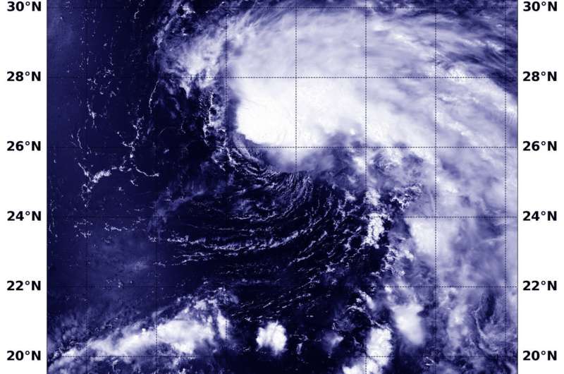
NASA finds tropical storm Wukong's comma shape

Tropical Depression 14W formed on July 22 and the next day, NASA's Aqua satellite captured an image of the storm that had strengthened into a tropical storm and taken on a comma shape.
Tropical Depression 14W was renamed Wukong when it became a tropical storm at 5 p.m. EDT (2100 UTC) on July 22.
The Moderate Resolution Imaging Spectroradiometer or MODIS instrument aboard NASA's Aqua satellite caught a visible light image of Tropical Storm Wukong on July 22 at 10:55 p.m. EDT (July 23 at 0255 UTC). The MODIS image showed powerful thunderstorms around the low-level center of circulation and a band of thunderstorms extending from the eastern quadrant, giving the storm a comma-shaped appearance.
At 5 a.m. EDT (0900 UTC) the Joint Typhoon Warning Center or JTWC noted that Tropical Storm Wukong had maximum sustained winds near 45 knots (51.7 mph/83.3 kph). It was located near 26.1 degrees north latitude and 159.4 degrees east longitude, about 315 nautical miles east-northeast of Minami Tori Shima, Japan. Wukong continued moving north at 10 knots (11.5 mph/18.5 kph).
The JTWC forecast calls for Wukong to move generally north. The JTWC expects Wukong to strengthen to 60 knots (69 mph/111.1 kph) before turning extra-tropical to the east of Japan.
Provided by NASA's Goddard Space Flight Center


